A Winter Storm Watch has been issued for Prince William County, Manassas, and Manassas Park as forecasters track a coastal storm that could bring accumulating snow late Sunday into Monday.
Key Takeaways

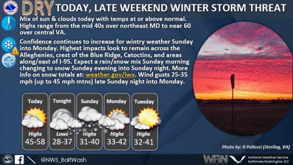
A Winter Storm Watch has been issued for Prince William County, Manassas, and Manassas Park as forecasters track a coastal storm that could bring accumulating snow late Sunday into Monday.
Key Takeaways
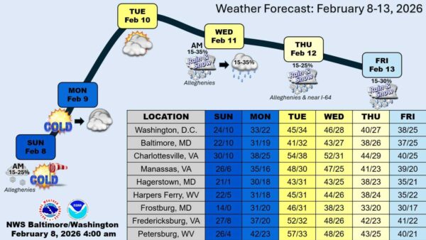
Dangerously cold temperatures and high winds swept through the Potomac Communities region over the weekend, with forecasters now pointing to a dramatic warmup later this week.
Key Takeaways

City officials said downtown Fredericksburg is open, though sidewalks and ADA access points are still being cleared and pedestrians should use caution. Neighborhood streets have been addressed, and additional heavy equipment is being used to break through compacted ice as cleanup continues.

Here are the latest school closings for Thursday, January 29, 2026. We’ll post more as they come in.
PWCS Reverses Course, Closes Thursday

“Due to the current temperatures and icy conditions, enforcement of the City’s sidewalk snow-removal ordinance is temporarily suspended,” the City of Manassas announced. “Residents are still encouraged to help neighbors when possible and to do what they can to improve safety, including clearing walkways or spreading salt or sand in areas where ice cannot be safely removed.”
City officials said residents who need help clearing sidewalks can call 571-292-5316. The city partners with Volunteer Prince William through an assisted snow-shoveling program aimed at helping high-risk residents unable to clear sidewalks on their own. Additional snow-removal resources are available on the city’s website.

“Due to current road conditions, service will be suspended on Tuesday,” American Disposal Services of VA [posted] on Facebook. “American Disposal Services of VA will continue to monitor road conditions closely and provide updates regarding service as they become available.”
Customers are encouraged to check the company’s website, mobile app, and Facebook page for the latest updates on when service may resume.

“The Prince William Ice Center will not open before 5 pm today, Tuesday, January 27th,” Prince William Ice Center posted on Facebook.
The ice rink in Woodbridge had been scheduled to open earlier in the day but will now remain closed until at least 5 p.m. today. Check the center’s social media or call ahead if you plan to visit later this evening.
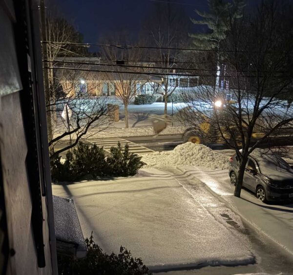
A Potomac Local reader, Sue Nelson-Sargeant, reports snowplowing activity on primary roads and neighborhood streets late Monday evening near St. Mary’s Catholic Church.
According to Nelson-Sargeant, plows were actively clearing roads around the intersection of William and Daniel streets around 6:15 p.m. The activity continued overnight as crews worked through the area.
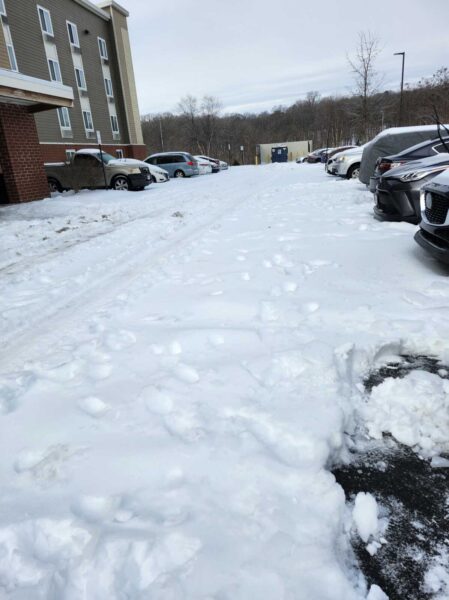
A guest at a Stafford County hotel reported hazardous driving conditions on the property after a winter storm, saying internal roads and parking areas had not been plowed.
Key Takeaways
“Stafford County Government will be closed on Tuesday, January 27, 2026, due to inclement weather,” Stafford County government announced. “Stafford County Public Schools, all Stafford County courts, and the Stafford County Board of Supervisors meeting scheduled for Tuesday, January 27, are also closed or canceled.”
County officials said the Regional Landfill and Belman Road Recycling Center will open two hours late on Tuesday, January 27, while other county government operations remain closed due to weather conditions.