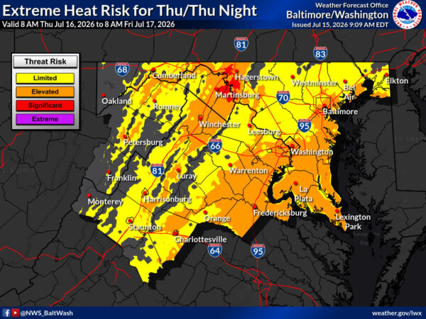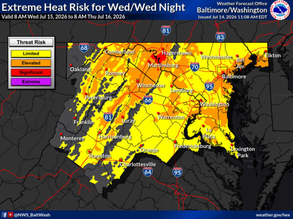
Residents across Northern Virginia are bracing for another day of dangerous heat on Wednesday, with the National Weather Service (NWS) office in Baltimore/Washington, D.C. forecasting highs near 102°F and heat index values as high as 107°F. Heat Advisories remain in effect for most of the region outside the mountains and southern Shenandoah Valley.

Sunny skies and light west winds around 6 mph will dominate the day, but the combination of high temperatures and humidity will make it feel significantly hotter. Overnight lows will dip to around 77°F under mostly clear skies, offering little relief from the oppressive conditions.


After a relatively mild stretch, a strong upper-level high-pressure system is bringing dangerously hot conditions back to the region. The National Weather Service Baltimore/Washington office is forecasting highs near 100°F on Wednesday, with Heat Advisories expected for much of Northern Virginia.

Today (Tuesday, July 14): Sunny, with a high near 91. Light south wind.


A hot and humid day continues across Northern Virginia, the District, and surrounding areas. Expect mostly cloudy skies with a high near 92°F. Winds will be light and variable, becoming west around 5 mph this afternoon.

There is a 30% chance of showers and thunderstorms, mainly after 4 p.m. Stay alert for brief heavy downpours or gusty winds if storms develop.


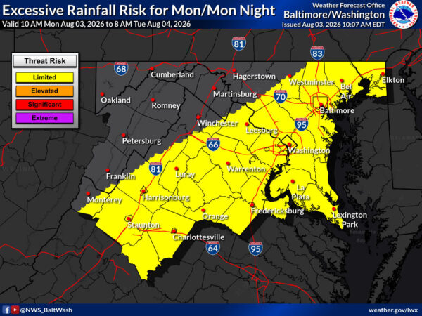
The National Weather Service office in Baltimore/Washington has expanded a Flood Watch and Slight Risk of severe thunderstorms westward to cover additional portions of the Shenandoah Valley and the I-81 corridor.

A surface front and a strong shortwave moving from the Ohio and Tennessee Valleys will bring widespread thunderstorm activity to the region through Friday. Ample moisture from a tropical air mass, with precipitable water values of 2 to 2.25 inches, will support heavy rainfall.


Residents across Northern Virginia should expect a mostly cloudy day with periods of showers on Wednesday, according to the National Weather Service (NWS) Baltimore-Washington, D.C. office. Low clouds, patchy fog, and isolated showers will dominate the morning hours.

High temperatures will remain below average for early July, generally reaching the upper 70s to low 80s in most spots, with a high near 84 possible in warmer locations. Winds will be light from the east at 3 to 5 mph. The chance of precipitation is around 30%, with most of the day’s convection expected to remain west of U.S. 15.


A combination of a stalled frontal boundary and a persistent tropical air mass will increase the risk of flash flooding in central Virginia this afternoon and evening.

Flood Watches have been issued for much of central Virginia, extending northward along the I-81 corridor into eastern West Virginia. Residents in low-lying areas, near streams and rivers, and in urban areas with poor drainage should remain alert for rapidly rising water levels.


FLOOD WATCH REMAINS IN EFFECT from 4 PM EDT this afternoon through this evening for Washington DC, much of Maryland, Northern Virginia, and eastern West Virginia.

The National Weather Service Baltimore MD/Washington DC has warned of an increased risk of flash flooding this afternoon and evening due to a slow-moving frontal zone and tropical air mass in place.


“A severe thunderstorm watch has been issued for parts of District of Columbia, Maryland, Virginia and West Virginia until 11 PM EDT,” NWS Wakefield announced.

Scattered showers and thunderstorms are expected this afternoon after 5 p.m. with a 30% chance of precipitation, increasing to likely showers and thunderstorms tonight before 11 p.m. with a 70% chance.


“Scattered severe thunderstorms are possible this afternoon and evening as a cold front tracks south through the Mid-Atlantic. Lightning, damaging gusty winds, and isolated hail are possible.” NWS Baltimore-Washington reported.

Showers and thunderstorms are likely tonight before midnight, then isolated showers between midnight and 1am. Low around 65. Monday brings mostly sunny skies with a high near 82 and northwest winds 10 to 15 mph with gusts up to 21 mph.


“Drier conditions on Saturday as high pressure moves into the Mid-Atlantic. Severe thunderstorm chances return on Sunday with an incoming cold front from the northwest,” NWS Baltimore-Washington reported. “Somewhat cooler temperatures and mostly cloudy conditions are expected Monday.”

Today features sunny skies with a high near 90. Sunday brings a 60% chance of showers and thunderstorms, a high near 94 with heat index values up to 100, followed by a 40% chance of storms Sunday night. Monday looks mostly sunny with a high near 81.


View More Stories