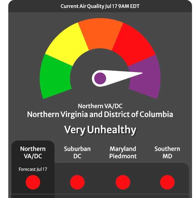
Smoke from Canadian wildfires has reduced visibility to as low as 1-2 miles in spots. Air quality is expected to remain poor through today and possibly into tonight. Sensitive groups (people with heart/lung conditions, older adults, and children) should avoid all outdoor physical activity. Healthy individuals should avoid prolonged or strenuous outdoor exertion.
Today’s Forecast (Friday, July 17)
- Partly sunny with widespread smoke.
- High near 93°F.
- North wind around 5 mph becoming calm.
- Poor air quality persists; check AirNow.gov or COG’s website for updates.
Tonight
- Widespread smoke, mainly before 2 a.m.
- Mostly cloudy, low around 73°F.
- Light southeast wind.
Saturday Outlook
- Patchy smoke early, then a strong chance of showers and thunderstorms (especially after 5 p.m.).
- High near 95°F with heat index values up to 105°F.
- 80% chance of precipitation; rainfall of ¼ to ½ inch possible, higher in thunderstorms.
- Southwest winds 6-11 mph, gusts to 20 mph.
- A strong cold front may bring severe weather threats, including damaging winds and heavy rain.
Saturday Night
- Showers and possible thunderstorms before 2 a.m., then slight chance of showers.
- Low around 74°F.
- 80% chance of precipitation; additional rainfall of 0.1 to 0.25 inches possible.
Sunday
- Mostly sunny with a slight chance (20%) of showers and thunderstorms after 2 p.m.
- High near 89°F.
- Cooler and less humid behind the front.
Health and Safety Recommendations from COG and AirNow
- Reduce exposure to wildfire smoke: Avoid strenuous activities like running or mowing if you can see or smell smoke.
- Reschedule outdoor work; take frequent indoor breaks in clean air spaces.
- Use N95 masks for necessary outdoor tasks (cloth masks offer no protection).
- Run portable air cleaners or central AC with a filtration system.
- On unhealthy air days: Avoid lawn mowing (or use an electric mower), use gas/electric grills instead of charcoal, fill gas tanks after sunset, carpool/transit/work from home, and conserve electricity.
The NWS notes a strong cold front will increase severe weather risks Saturday, with possible lingering threats south of I-64 on Sunday. High pressure brings drier, more seasonable conditions Monday before another front midweek.