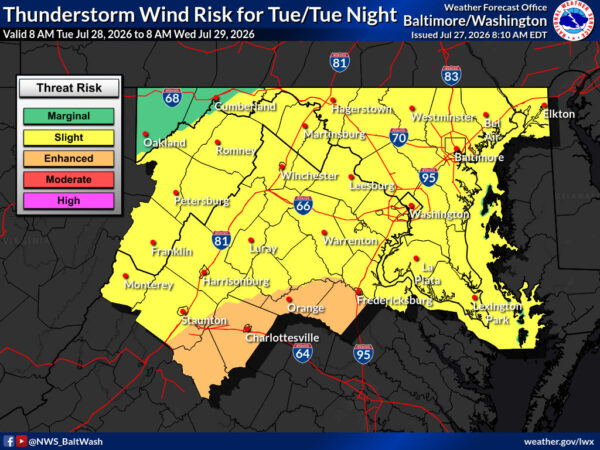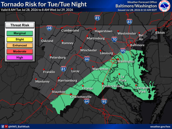
A strong cold front will push across the region this afternoon and evening, bringing a slight risk of severe thunderstorms. Damaging winds are the main threat, with large hail and a brief tornado also possible. Heavy downpours are likely in stronger storms, and a Flood Watch is in effect for parts of northeast Maryland through early Wednesday.
An upper-level trough may increase clouds and shower chances by Saturday evening into Sunday.