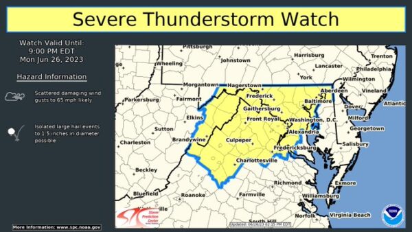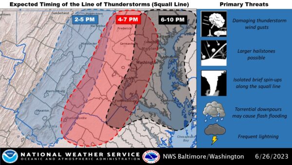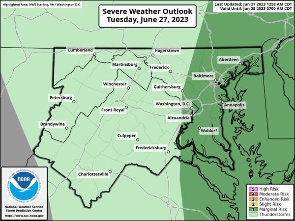
National Weather Service Baltimore-Washington: “As a slow-moving cold front tracks through, there will be a lingering thunderstorm threat. A few may become severe along and east of I-95. Expect drier conditions with less humidity on Wed/Thu before a return to a summertime pattern by Fri. ”
“Today: Showers and thunderstorms likely, then showers and possibly a thunderstorm after 3 pm. High near 86. Southwest wind 3 to 8 mph. The chance of precipitation is 80%. New rainfall amounts between a quarter and half of an inch possible.”