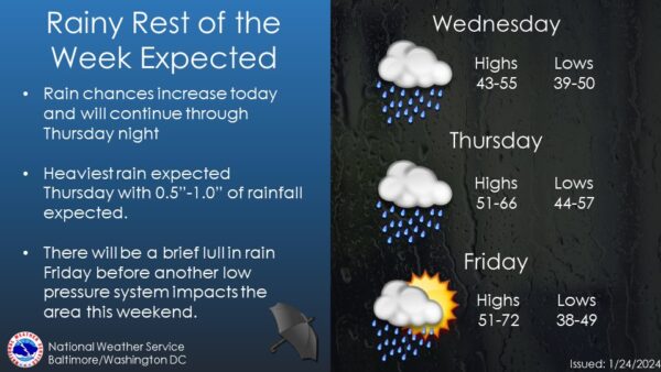
The National Weather Service forecast indicates that low pressure is moving from the Lower Mississippi Valley toward the Great Lakes through tonight. A weakening cold front associated with this system is expected to cross the region on Friday. Another wave of low pressure will approach from the Mid-South late Saturday into Sunday, with high pressure returning early next week.
In the near term (through tonight), rain is expected, especially in northern and western parts of the area. A warm front bisects southern Maryland to Stafford/Orange Counties, leading to temperature differences. Fog development is limited, and a Dense Fog Advisory in northeast Maryland may be canceled with the incoming rain. Showers will continue through mid-morning, with a relative break during midday. Rain coverage will increase again in the late afternoon and evening.