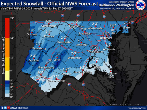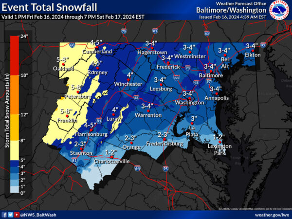
A significant weather system will sweep the region tonight, bringing heavy snowfall and potentially hazardous travel conditions. According to the latest forecast from the National Weather Service, an area of low pressure is projected to pass to the south overnight into Saturday morning, triggering widespread snowfall across the area.
The day started with gusty northwest winds, reaching 40 to 50 mph speeds in some areas, particularly along and west of the Blue Ridge. However, winds are expected to calm down as a weak surface high-pressure system slides by this afternoon. Despite the decrease in wind activity, dry weather is anticipated, with temperatures reaching seasonable highs in the 40s to lower 50s.