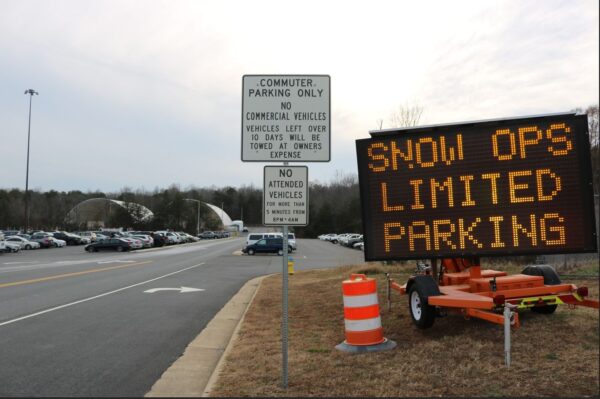
The advisory is in effect from 2 a.m. to 9 a.m. Thursday, April 17, covering much of central, northern, and northwest Virginia, portions of Maryland including northern and central counties, and parts of eastern West Virginia.

Temperatures are expected to dip to between 33 and 36 degrees, creating conditions favorable for frost to form. Tender vegetation, including spring flowers, garden plants, and early crops, could be harmed or killed if left unprotected.


Residents across Northern Virginia and the surrounding region should prepare for a sharp plunge in temperatures tonight, with conditions expected to reach near-record lows. The National Weather Service reports that a powerful high-pressure system is moving into the area, ushering in clear skies, dry air, and cold temperatures through the middle of the week.

Forecasters say tonight’s weather will create “ideal radiational cooling conditions,” allowing heat from the ground to escape into the atmosphere. Low temperatures are projected to dip into the 20s for most areas, with some of the coldest locations possibly reaching the mid to upper teens. Urban cores like Fredericksburg and Manassas may stay around freezing, but are still expected to see unseasonably cold weather.


According to the National Weather Service (NWS), a potent weather system is set to impact the region today, bringing strong storms and gusty winds.

A deepening area of low pressure and an associated cold front will move across the region Wednesday, ushering in a line of showers and thunderstorms. Some storms may become severe, followed by a prolonged period of strong winds from Wednesday night into Thursday afternoon.


A winter storm bringing snow and strong winds will force schools in Stafford County, Fredericksburg City, and Spotsylvania County to close on Thursday, February 20, 2025.

Stafford County Public Schools will be closed, with all 12-month staff operating on a two-hour delay. As a result of this closure, Friday, March 21, 2025, will now be a regular, full instructional day for students to make up for the lost classroom time.


Bitterly cold air is sweeping into the region, but the anticipated snowstorm will largely miss Northern Virginia. Instead, it will track south toward Williamsburg and Virginia Beach, where accumulations are expected to be significant.

According to the National Weather Service, an expansive Arctic high-pressure system is building into the north-central U.S., reinforcing the cold snap. Meanwhile, an area of low pressure developing over the Mississippi River Valley will move toward the Carolinas before heading offshore midweek. As a result, the heaviest snowfall will stay well to the south, sparing much of Northern Virginia, the Washington, D.C. area, and Maryland from significant impacts.


The National Weather Service has issued a High Wind Warning for much of the region. Strong winds are expected to develop Sunday morning and persist through Monday, with wind gusts reaching up to 60 mph in some areas.

The warning is in effect from 10 a.m. to 10 p.m. Sunday, with the strongest gusts anticipated in the afternoon and evening. Wind speeds of 20 to 30 mph with gusts of 50 to 60 mph are expected. These high winds could cause downed trees and power lines, leading to widespread power outages. Residents are advised to stay indoors, avoid windows, and secure outdoor objects.


Median Snow Totals by Region:

The heaviest snowfall totals were recorded in Manassas and parts of Stafford County, where accumulations neared 9.5 inches. Many roads across the region remain snow-covered and hazardous, prompting school closures and delays for Tuesday.


Updated – The National Weather Service (NWS) Baltimore-Washington office has issued a Winter Storm Watch for the region, warning of heavy snowfall and hazardous travel conditions from Tuesday afternoon through Wednesday morning.

Snowfall Forecast & Timing


A wintry mix of precipitation is expected, with snow and sleet accumulations up to 1 inch and ice accumulations up to one-tenth of an inch. The advisory covers the District of Columbia, central Maryland, and central and northern Virginia.

Precipitation will overspread the area Saturday morning, starting as snow. By the afternoon, it will transition to sleet and freezing rain, creating hazardous travel conditions. By the evening, temperatures will rise, changing the precipitation to cold rain, which may help reduce ice accumulation but could leave roads slick.


A winter storm is expected to impact the region starting Wednesday evening, bringing the potential for significant ice accumulation in some areas. The National Weather Service has issued an Ice Storm Warning for parts of the Potomac Highlands, Northern Shenandoah Valley, and Northern Virginia Blue Ridge.

Prince William County is under a Winter Weather Advisory from 9 p.m. Wednesday to Noon Thursday. Stafford County is currently not under any advisory.


View More Stories