I'm the Founder and Publisher of Potomac Local News. Raised in Woodbridge, I'm now raising my family in Northern Virginia and care deeply about our community. If you're not getting our FREE email newsletter, you are missing out. Subscribe Now!
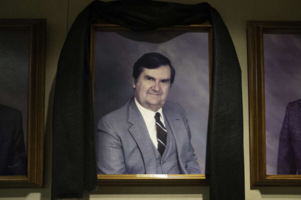
Stafford County is grieving the passing of Elmer Cassius “Bill” Williams, a dedicated public servant who left an indelible mark on the community. Williams, who served as the Aquia District representative on the Board of Supervisors from 1990 to 1993, passed away recently, leaving behind a legacy of commitment and service.
Williams was not only an esteemed member of the Board but was elected Vice Chairman by his fellow Board members in 1992 and 1993. Prior to his role on the Board of Supervisors, he dedicated 18 years of service to the Stafford County Planning Commission. His family’s roots in Stafford County date back to 1859, and they have a storied history of contributing to local governance.