
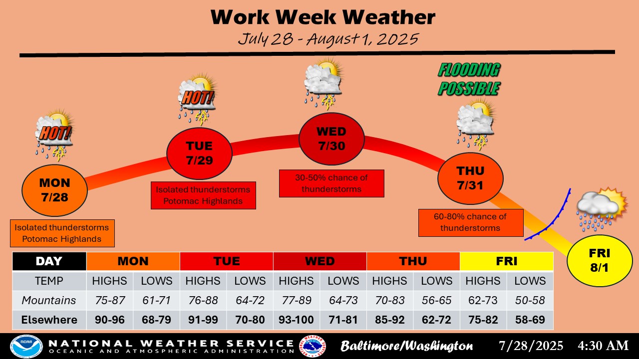
After a sweltering weekend that brought heat index values over 100 and a heat advisory, today feels like a slight relief. Highs will reach the low 90s, but lower humidity and fewer storms will make conditions feel more manageable. Looking ahead, hot and humid weather returns through midweek, with highs climbing into the mid to upper 90s by Wednesday. However, a strong cold front arrives late in the week, bringing the chance for showers and storms—followed by a significant drop in temperatures heading into the weekend.
Weather Highlights
-
Today (Monday): Highs near 92°F; less humid and mostly dry with a few storms possible in the mountains.
-
Tuesday: Hot and humid again with highs in the low-to-mid 90s; heat index up to 105°F.
-
Wednesday: Hottest day of the week—highs in the mid-to-upper 90s and heat index potentially reaching 110°F; isolated evening storms.
-
Thursday: Cold front moves in with showers and thunderstorms likely; risk for heavy rain and localized flooding.
-
Friday: Cooler with a chance of lingering showers; highs in the upper 70s to low 80s.
-
Weekend: Much cooler and more comfortable with sunshine and low humidity; highs in the 70s and lows in the 50s.