
Temperatures will rise into the 90s Friday, Saturday, and Sunday for the first time since last Autumn.
Friday will be the first 90-degree day in the Baltimore and Washington Metropolitan Areas since last September, according to the National Weather Service.
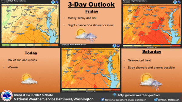
Saturday is forecast to be the hottest day of the weekend, with many locations reaching the mid-90s and heat indices approaching 100. The heat will continue through Sunday.
The abrupt beginning of hot temperatures early in the season after a relatively cool spring increases the risk of heat illnesses unless proper precautions are taken for those working or recreating outdoors.
Since many outdoor events are planned this weekend in the region, be aware of the heat, and take extra precautions if you work or spend time outside this weekend. Reschedule strenuous activities to early morning or evening. Plan to wear lightweight and loose-fitting clothing and seek shade from the sun. Schedule frequent rest breaks in shaded or air-conditioned environments and stay hydrated with non-alcoholic beverages.
Here’s the forecast:
Friday
Mostly sunny, with a high near 92. Calm wind becoming south 5 to 7 mph in the morning.
Friday Night
Mostly clear, with a low around 73. Southwest wind around 6 mph.
Saturday
Sunny, with a high near 95. Southwest wind around 6 mph.
Saturday Night
Partly cloudy, with a low around 72. Southwest wind around 6 mph.
Sunday
A chance of showers and thunderstorms after 2 pm. Mostly sunny, with a high near 93. The chance of precipitation is 40%.
Sunday Night
A chance of showers and thunderstorms before 8 pm, then a chance of showers between 8 pm and 2 am. Mostly cloudy, with a low around 67. The chance of precipitation is 50%.
Monday
Showers are likely, mainly after 2 pm. Mostly cloudy, with a high near 79. The chance of precipitation is 60%.