
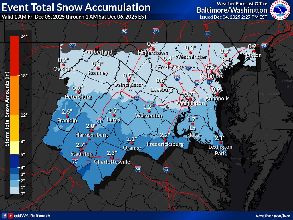
A fast-moving winter system and very cold temperatures will make travel hazardous across Stafford, Prince William, Fairfax, Spotsylvania, and surrounding counties early Friday. The National Weather Service has expanded the Winter Weather Advisory northward, now covering much of Northern Virginia and central Maryland as confidence increases in light—but high-impact—snow during the Friday morning commute. Snow is expected to begin between 3–5 a.m., with temperatures in the 20s ensuring it sticks immediately to untreated roads, sidewalks, and bridges. Even a coating to an inch of snow may cause slick, icy, and treacherous conditions, especially during peak travel hours.
Forecasters say models have shifted quicker and farther north today, tightening confidence that many areas will see at least light accumulation. While higher totals of 1–2 inches remain most likely farther south across Spotsylvania and central Virginia, areas to the north—including Prince William, Stafford, and Fairfax—are now expected to receive a coating to around one inch. Strong upper-level jet forcing may also briefly enhance snowfall in narrow bands. As the snow winds down late morning, patches of freezing drizzle may develop into the afternoon, potentially prolonging slick conditions.
Outlook
- Friday: Snow moves in early morning, tapering by late morning. A coating to 1″ for Stafford, Prince William, Fairfax; 1–2″ further south. Very hazardous commute. Freezing drizzle possible afternoon/evening.
- Saturday: Dry but mostly cloudy. Highs in the low–mid 40s.
- Sunday: Quiet, seasonable conditions with high pressure.
- Monday: Another fast-moving system may bring light wintry precipitation.
- Tuesday: Cold continues with additional clipper-like disturbances possible.