

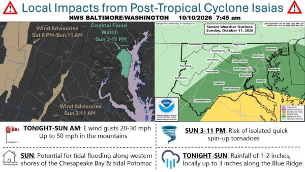
Remnants of Hurricane Isaias will bring periods of rain, breezy conditions, and a chance of thunderstorms to Manassas, Fredericksburg, and Woodbridge starting tonight and continuing through Sunday, according to the National Weather Service Baltimore/Washington. Rain is expected to begin late tonight and become widespread Sunday, with totals of three-quarters to one inch possible in many spots and locally higher amounts. East winds will increase Sunday, with gusts of 23 to 26 mph, and a few thunderstorms could develop Sunday afternoon, mainly east of the Blue Ridge.
Conditions improve Monday as the system moves offshore, with partly sunny skies and highs in the mid-70s. Tuesday turns sunny and warmer, with highs near 80 to 82 degrees across the three areas. No Flood Watch is in effect for the region at this time, though the National Weather Service continues to monitor rainfall amounts.
