

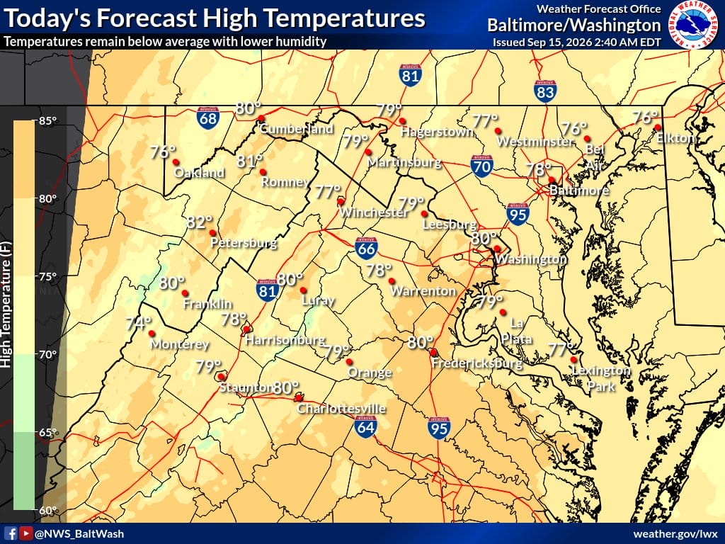
Canadian high pressure is in control today. That means a cool and dry start to the work week for the Baltimore-Washington region.
Early morning temperatures are in the upper 40s to 50s, with a few spots in the mid-40s near the Alleghenies. Patchy fog is possible in river valleys and low spots before sunrise, but it should burn off quickly.
Expect mostly sunny skies and light winds today. Highs will reach the mid-70s to low 80s. Humidity stays low, with dew points in the upper 40s to low 50s. It will feel much more comfortable than recent days.
Tonight stays clear with light winds. Lows will be milder than last night, mainly in the mid-50s to low 60s. The I-95 corridor and areas near the Potomac and Chesapeake Bay will be the mildest.
A warm-up is on the way. Wednesday and Thursday look warmer and a bit more humid, with highs climbing into the mid to upper 80s and even low 90s in a few spots. Dry weather holds through most of the week. Shower and thunderstorm chances return late in the week and into the weekend as a front approaches.
Weather headlines
- Cool and dry Tuesday under Canadian high pressure
- Mostly sunny with highs mid-70s to low 80s
- Low humidity; dew points upper 40s to low 50s
- Light winds after breezy Monday
- Milder overnight lows in the 50s and 60s
- Warming trend Wednesday and Thursday into the 80s
- Storm chances return late week into weekend
Weather aware / precautions
- Watch for patchy fog in valleys early this morning
- Dress in layers for the cool start and mild afternoon
- Enjoy the pleasant low-humidity sunshine
- Small Craft Advisory ends early for southern waters
- Plan outdoor activities while the dry weather lasts
- Stay weather aware as storm chances increase late week
