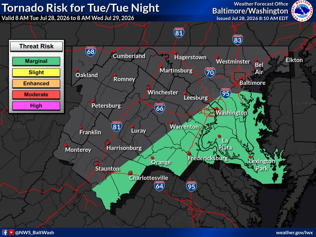
A strong cold front will push across the region this afternoon and evening, bringing a slight risk of severe thunderstorms. Damaging winds are the main threat, with large hail and a brief tornado also possible. Heavy downpours are likely in stronger storms, and a Flood Watch is in effect for parts of northeast Maryland through early Wednesday.
Today
A chance of showers and thunderstorms before 2 p.m., then showers and possibly a thunderstorm between 2 and 4 p.m., followed by showers and thunderstorms likely after 4 p.m. High near 87. South wind 7 to 10 mph with gusts up to 20 mph. Chance of precipitation 90 percent. Rainfall amounts of a quarter to half an inch possible.
Tonight
Showers and thunderstorms likely, mainly before 10 p.m. Mostly cloudy early, then gradual clearing. Low around 68. Light and variable winds becoming northwest around 6 mph after midnight. Chance of precipitation 60 percent. New rainfall of a tenth to a quarter of an inch possible, with higher amounts in thunderstorms.
Wednesday
Sunny with a high near 86. Northwest wind 8 to 13 mph with gusts as high as 21 mph.
Outlook
High pressure builds in behind the front, bringing slightly cooler and drier conditions Wednesday and Thursday. A few rain chances remain possible through the weekend, mainly farther north and east, but no hazardous weather is expected from Wednesday through Sunday.
An upper-level trough may increase clouds and shower chances by Saturday evening into Sunday.