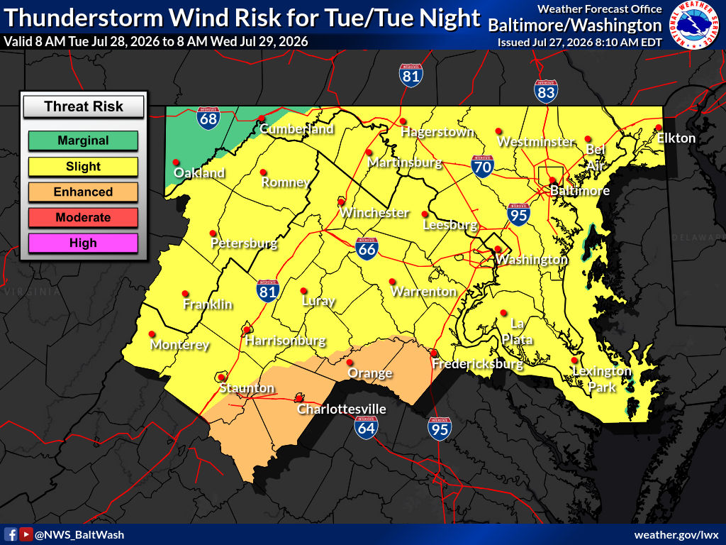
Showers and thunderstorms are possible early this week as a strong frontal boundary moves through the region. Severe thunderstorms are possible Tuesday, with damaging winds and heavy rain the primary concerns. Conditions turn drier and sunnier later in the week.
Today
A slight chance of showers and thunderstorms is expected between 2 and 5 p.m. Mostly sunny skies will prevail with a high near 88 degrees. Winds will be calm. Chance of precipitation is 20%.
Tonight
A slight chance of showers and thunderstorms is forecast between 10 and 11 p.m. Clouds will increase, with a low around 69 degrees. Winds will be light and variable. Chance of precipitation remains 20%.
Tuesday
Showers are expected, with showers and possible thunderstorms after 11 a.m. Highs will reach near 87 degrees under south winds of 6 to 11 mph, gusting as high as 21 mph. Chance of precipitation is 90%. Rainfall amounts of a quarter to half an inch are possible.
Tuesday Night
Showers and thunderstorms are likely before 11 p.m., with a slight chance of showers lingering until 2 a.m. Lows will settle around 68 degrees. Southwest winds around 6 mph will shift to the west after midnight. Chance of precipitation is 80%. Additional rainfall of a tenth to a quarter of an inch is expected, with higher amounts possible in thunderstorms.
Wednesday
Mostly sunny skies return with a high near 86 degrees. Northwest winds of 8 to 11 mph will gust as high as 20 mph.
Outlook
A strong cold front will move through the area Tuesday, bringing the main severe weather threat. Damaging wind gusts are the primary hazard, though large hail is possible mainly across southern portions of the region and a brief tornado threat cannot be ruled out near the surface low.
By Thursday, high pressure builds overhead, reducing precipitation chances and bringing calmer conditions. Temperatures will gradually climb into the upper 80s, though drier air aloft should keep heat indices close to actual air temperatures. Precipitation chances increase again over the weekend as an upper-level trough approaches.