

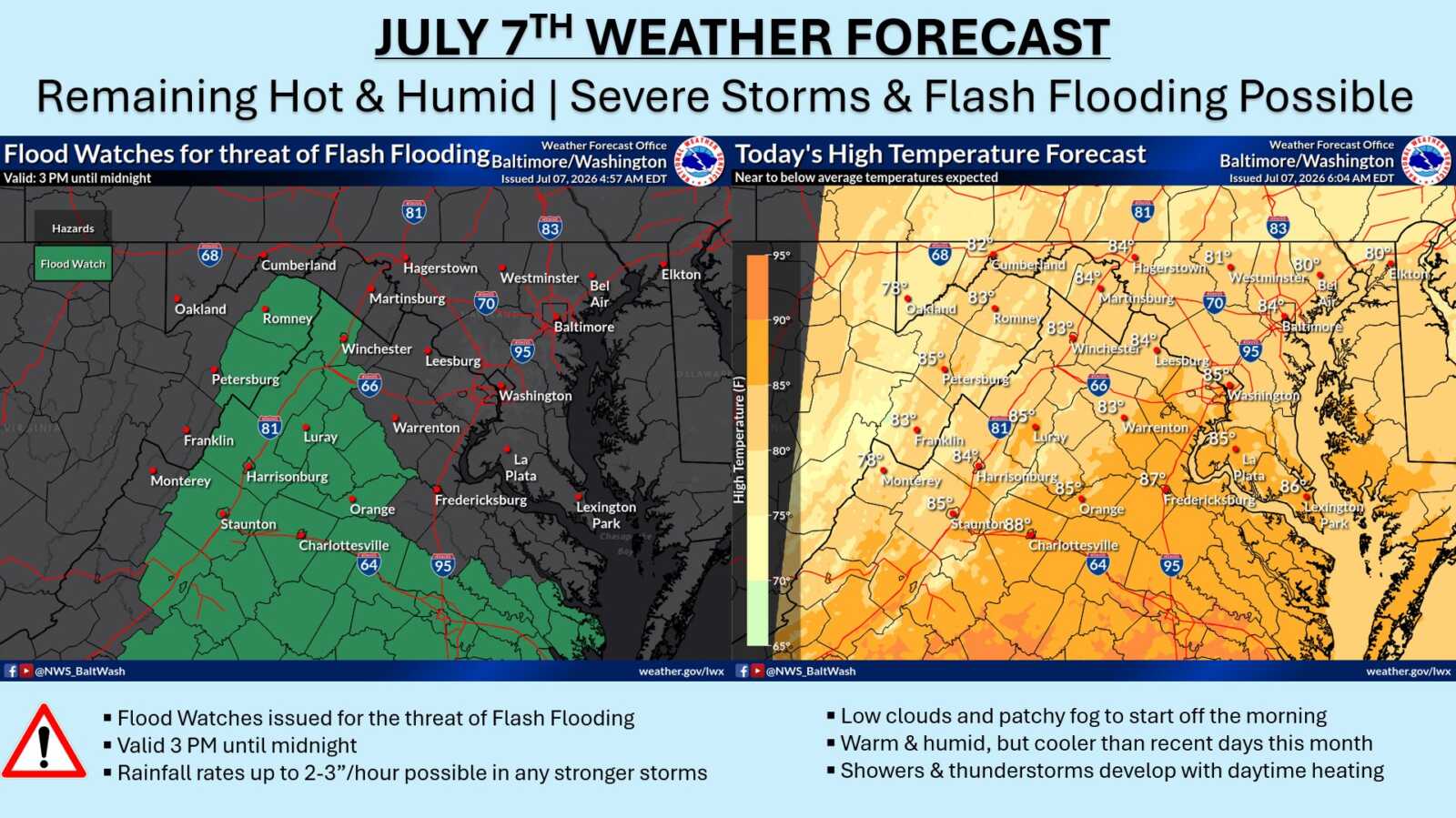
A combination of a stalled frontal boundary and a persistent tropical air mass will increase the risk of flash flooding in central Virginia this afternoon and evening.
Flood Watches have been issued for much of central Virginia, extending northward along the I-81 corridor into eastern West Virginia. Residents in low-lying areas, near streams and rivers, and in urban areas with poor drainage should remain alert for rapidly rising water levels.
Today’s highs will be noticeably cooler than the scorching temperatures of the past week.
This Afternoon
Scattered showers and thunderstorms are expected to develop mainly after 2 p.m. Mostly cloudy skies with a high near 84. Northeast winds around 5 mph. Chance of precipitation: 40%.
Tonight
Scattered showers and thunderstorms will continue. Patchy fog is possible between 3 a.m. and 5 a.m. Otherwise, mostly cloudy with a low around 71. Northeast winds 3 to 5 mph. Chance of precipitation: 50%.
Wednesday
A chance of showers before 4 p.m., followed by only a slight chance of showers and thunderstorms between 4 and 5 p.m. Patchy morning fog before 10 a.m. will give way to clouds gradually becoming mostly sunny. High near 83 with northeast winds around 6 mph. Chance of precipitation: 30%.
Motorists should slow down and avoid driving through flooded roadways. Never attempt to cross swiftly moving water. Check local forecasts and road conditions frequently.
