
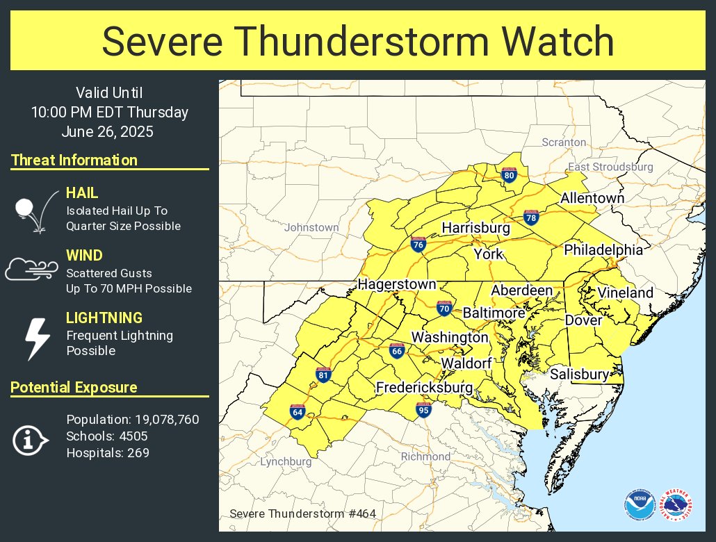
A ridge of high pressure remains in place, keeping the region hot and humid today. Scattered thunderstorms are likely to develop this afternoon and evening, bringing the risk of heavy rain, damaging wind gusts, and frequent lightning. With high moisture levels and slow-moving storms, localized flash flooding—especially east of the Blue Ridge and along the I-95 corridor—is a real concern. A Heat Advisory remains in effect until 7 p.m., with heat index values reaching 102 to 107 degrees.
Here’s what to expect over the next few days:
-
Thursday: Hot and humid with highs in the low-to-mid 90s. Scattered afternoon and evening storms may bring gusty winds, heavy rainfall, and flash flooding.
-
Friday: Continued hot and humid with more showers and storms. Highs in the upper 80s to low 90s.
-
Saturday: Slightly cooler with a chance of lingering showers as a stalled front begins to lift north. Highs in the mid-80s.
-
Sunday: Drier conditions likely with partly sunny skies. Highs in the mid-80s.
-
Early Next Week: A stronger cold front may arrive, bringing cooler temperatures and a renewed chance of storms.
Stay weather-aware and take precautions during the heat of the day.