

Canadian high pressure still covers the Baltimore-Washington region, but it has edged closer to the coast. That opens the door to a warmer day than early in the week.
Early morning temperatures are mostly in the upper 50s to low 60s, with mid-60s near Washington, Baltimore, and spots along the I-95 corridor and the bay. Skies are mostly clear. A little patchy fog is possible in mountain valleys and low spots before sunrise.
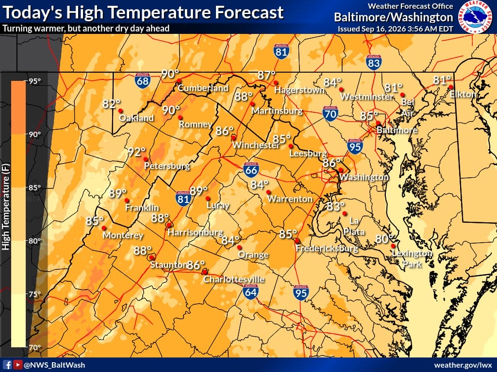
Today stays dry and mostly sunny. Highs climb into the mid to upper 80s, with a few low 90s possible in Allegheny mountain valleys. Humidity creeps up on a light south wind, but it should still feel manageable.
Tonight brings more clouds, mainly north of I-66 and U.S. 50. Lows settle in the low to mid 60s with that continued south breeze.
Thursday looks hotter, near 90 in many spots, with humidity up again. An approaching cold front brings the next chance of showers and thunderstorms, mostly west of U.S. 15 toward the Shenandoah Valley at first. Storms that push east should weaken. Friday turns breezier and a bit cooler after the front, with highs more in the upper 70s to mid 80s. The weekend stays unsettled and less certain as the front meanders near the region.
Weather headlines
- Warmer Wednesday with highs mid to upper 80s
- Mostly sunny and dry under high pressure
- Humidity rising on light south winds
- Milder overnight lows in the 60s
- Thursday hotter near 90 with storm chances, mainly west early
- Friday cooler and breezier after a cold front
- Unsettled pattern possible into the weekend
Weather aware / precautions
- Watch for patchy fog in valleys early this morning
- Dress lighter for the warmer afternoon
- Keep plans flexible Thursday if storms fire west of U.S. 15
- Expect breezier conditions Friday after the front
