

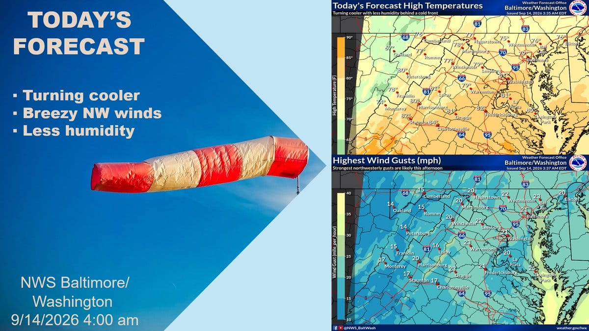
A cold front is moving through the Baltimore-Washington area this morning. Behind it, cooler and much less humid air is settling in under Canadian high pressure.
Expect mostly sunny skies today. Highs will run from the mid-70s to low 80s. Northwest winds will be breezy, with gusts of 20 to 25 mph this afternoon, and maybe near 30 mph in a few spots. Dew points will drop into the mid to upper 40s, so it will feel much less sticky than recent days.
Tonight looks clear and chilly. Lows will fall into the upper 40s to mid-50s, with the I-95 urban corridor a bit milder in the upper 50s.
Tuesday stays dry and sunny with lighter winds and highs again in the mid-70s to low 80s. A gradual warm-up begins by mid-week, with temperatures climbing back into the mid to upper 80s by Wednesday and Thursday. Dry weather should hold through Thursday, with shower chances possible along a front late in the week.
Weather headlines
- Cold front ushers in cooler, drier air Monday
- Mostly sunny with highs mid-70s to low 80s
- Breezy northwest winds gusting 20-25 mph
- Much lower humidity; dew points in the 40s
- Chilly Monday night lows in the 40s and 50s
- Dry and sunny Tuesday, then gradual warm-up
Weather aware / precautions
- Secure loose outdoor items; winds will be gusty this afternoon
- Dress in layers for the cooler daytime temperatures
- Expect a breezy morning and afternoon commute
- Enjoy the lower humidity after recent sticky days
- Plan for chilly overnight lows Monday into Tuesday
