Marine Corps Base Quantico says its operating status will be updated as forecasted winter weather approaches and impacts base operations this weekend. Officials are urging personnel and visitors to regularly check official channels for the latest information.

Updates will be posted on the base’s weather webpage, social media accounts, and sent through the MCB Quantico Mass Notification System as conditions evolve. The base also shared winter weather preparedness resources from surrounding local governments.
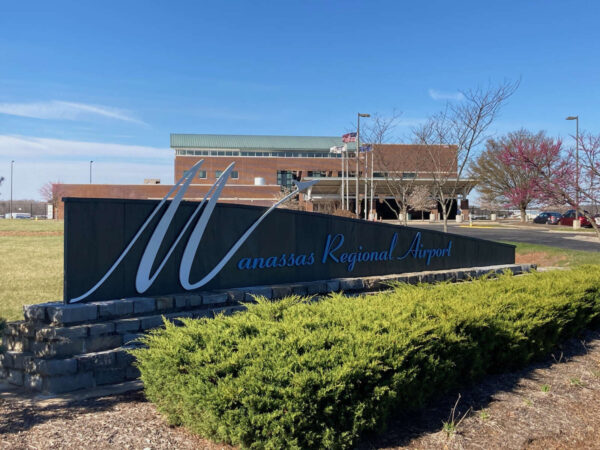
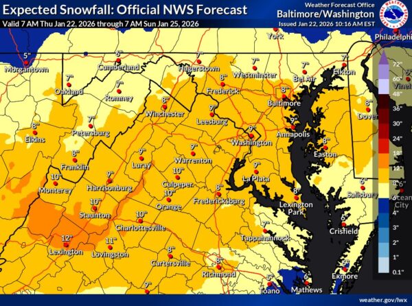
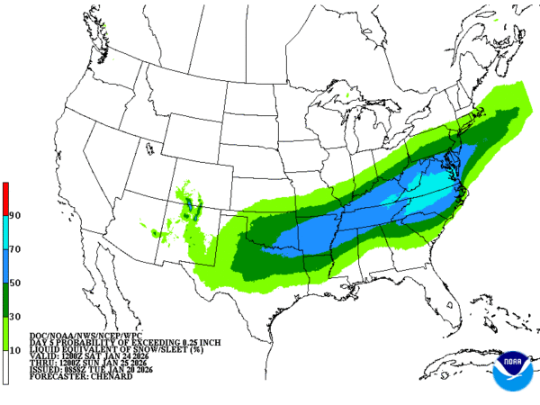
Manassas Regional Airport says it is actively monitoring a forecasted snow event expected to impact the region this weekend. Airport officials say crews, contractors, and specialized equipment are ready to respond if winter weather affects operations, with a focus on reopening runways as quickly as possible after snowfall ends.

The airport operates under an FAA-approved Snow and Ice Control Plan that outlines priorities during winter weather events. Airport stakeholders are encouraged to monitor NOTAMs, the airport’s website, and official social media channels for the latest operational updates as the storm approaches.


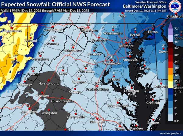
A major winter storm is increasingly likely to impact the region from late Saturday through Sunday, bringing heavy snow, areas of sleet and freezing rain, and significant travel disruptions.

Forecast confidence is high that most areas will see substantial winter weather, with some locations facing a dangerous mix of snow and ice. Bitterly cold air will follow the storm, with near record-low temperatures and wind chills lasting into early next week.


A weak system moved through the region Saturday, bringing light snow mainly to the mountains, with some lingering snow showers possible into the evening. Attention now turns to a second system late tonight into Sunday, which could bring light snow or a rain/snow mix, mainly east of the Blue Ridge. While any accumulation on Sunday should be minor for most areas, much colder air arrives early next week, with dangerously cold wind chills by Tuesday morning.

Outlook


Short answer: not really — but it’s too early to panic.

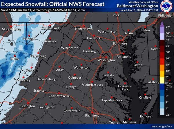
As of Sunday, January 11, 2026, forecasters at the National Weather Service say the second half of the upcoming week and next weekend could bring multiple chances for wintry weather, especially for areas west of the Blue Ridge — with lower, but not zero, chances farther east.


A period of light snow is possible early Wednesday morning across the Baltimore–Washington metro area, with the greatest concern during the morning commute. There is about a 30% chance of snow, but even a light coating could make roads slick and icy during rush hour. If snow develops, drivers could see slow travel, accidents, and delays before conditions improve later in the morning. Residents are urged to plan ahead, allow extra travel time, and consider telework or public transportation if possible.

Forecast Outlook


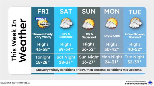
A strong cold front is pushing through the area this morning, bringing scattered showers early, followed by clearing skies and falling temperatures this afternoon. Gusty west winds will be the main concern today, with breezy conditions lasting into the evening before calming overnight. High pressure builds in Saturday with sunshine and lighter winds, followed by a milder and mostly sunny Sunday.

Upcoming Weather Outlook:


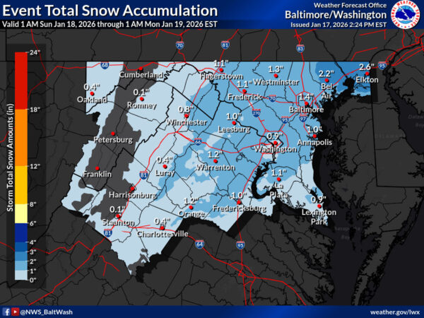
The Fredericksburg region narrowly missed out on a Winter Weather Advisory as a fast-moving band of snow targets portions of northern Virginia, Washington, D.C., and central to northeastern Maryland late Saturday into Sunday morning, according to the National Weather Service.

The advisory, issued by the National Weather Service Baltimore/Washington office, is in effect from midnight Saturday night through 10 a.m. Sunday for areas north of Fredericksburg, including much of the Interstate 95 corridor closer to Washington and Baltimore. Forecast snowfall totals in those areas range from 1 to 3 inches, with localized totals of 4 to 5 inches possible in far northeastern Maryland.


“Light snow showers could cause slippery road conditions in the Fredericksburg area, Northern Neck and Middle Peninsula over the weekend,” Virginia Department of Transportation announced. “Less than one inch of snow accumulation is forecast for most of the Fredericksburg area, with a potential for 1-2 inches of snow in northern Stafford County.”

“On Sunday afternoon and evening, gusting winds of 25-35 mph are forecast, which could lead to downed trees, tree limbs, and debris in the road,” the agency stated. “VDOT crews will mobilize in 24-hour emergency operations between late Saturday and early Sunday morning, depending on the arrival time for inclement weather in each region.”


View More Stories