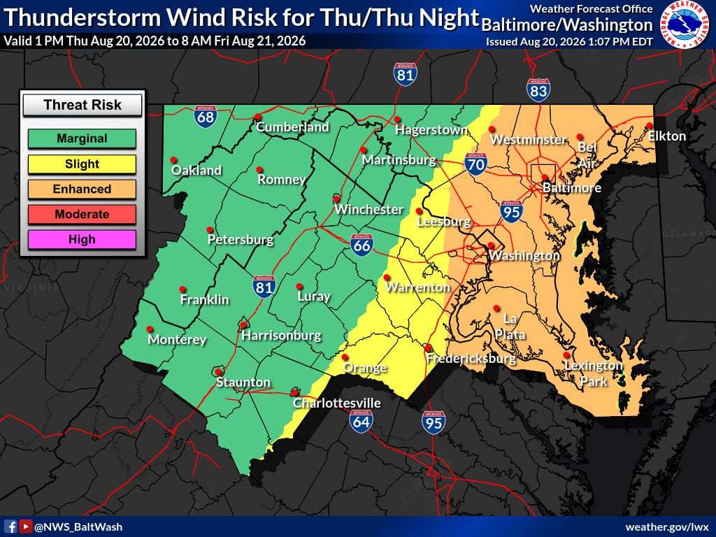
Numerous thunderstorms are expected this afternoon and evening across the region, mainly east of the Blue Ridge. Damaging wind gusts and a potential for a couple of tornadoes are possible, especially near northeast Maryland, along with a threat of urban flash flooding highest near and northeast of Baltimore.
Today
Numerous thunderstorms are expected between about 3 p.m. and 9 p.m. These storms may produce damaging winds and potentially a couple of tornadoes, especially near northeast Maryland. Urban flash flooding is also a threat, with the highest risk near and northeast of Baltimore. Storms may linger over southern Maryland through late evening.
Tonight
The severe weather and flash flood threat should end later this evening as large-scale lift departs and daytime heating is lost. Storms may continue over southern Maryland into the late evening.
Friday
A brief lull is expected. Shower and thunderstorm coverage and intensity should generally remain lower due to limited lifting mechanisms, though a stalled front will remain nearby.
Friday Night into Saturday
Additional showers and a few thunderstorms are possible as a surface low develops near the Virginia Tidewater and moves northeast along the coast, combined with another mid- and upper-level wave approaching from the west.
Sunday
A lingering chance of showers and thunderstorms is expected. Any stronger storms may be capable of producing some hail and locally gusty winds.
Outlook
Drier and less humid conditions are expected to start next week as high pressure builds in from the north. Northwesterly winds will bring lower humidity, with dewpoints falling into the 50s on Monday and Tuesday. Guidance begins to diverge by Wednesday, with some solutions showing higher humidity and a return of shower and thunderstorm chances.
Stay weather-aware and check official National Weather Service updates for the latest information.
“`