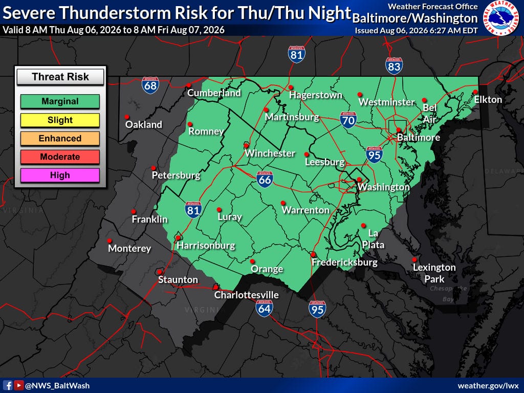
Hot and humid conditions will stick around through the weekend and into next week, with afternoon highs in the upper 80s to low 90s and heat indices reaching the low 100s. Daily chances of showers and thunderstorms remain in the forecast as a surface trough and shortwave energy move through the region. The risk of strong to severe storms, capable of producing damaging winds, is expected to increase, with the highest chances Friday and Saturday.
Today
Sunny, with a high near 92. Heat index values as high as 101. South wind 5 to 9 mph.
Tonight
A chance of showers and thunderstorms before 1 a.m., then a slight chance of showers between 1 a.m. and 2 a.m. Partly cloudy, with a low around 73. South wind 3 to 6 mph. Chance of precipitation is 30%.
Friday
Mostly sunny, with a high near 92. Heat index values as high as 101. Southwest wind 5 to 8 mph.
Outlook
The Bermuda High will keep hot and humid conditions in place into next week, with precipitable water values near or above 2 inches in the valleys. Scattered showers and thunderstorms are expected each afternoon. Increasing deep-layer shear raises the potential for strong to severe thunderstorms, especially Friday and Saturday when a more potent shortwave could support more organized storms. Damaging winds will be the main threat. Sunday may bring a short dry break before heat, humidity, and daily storm chances return Monday through much of next week.