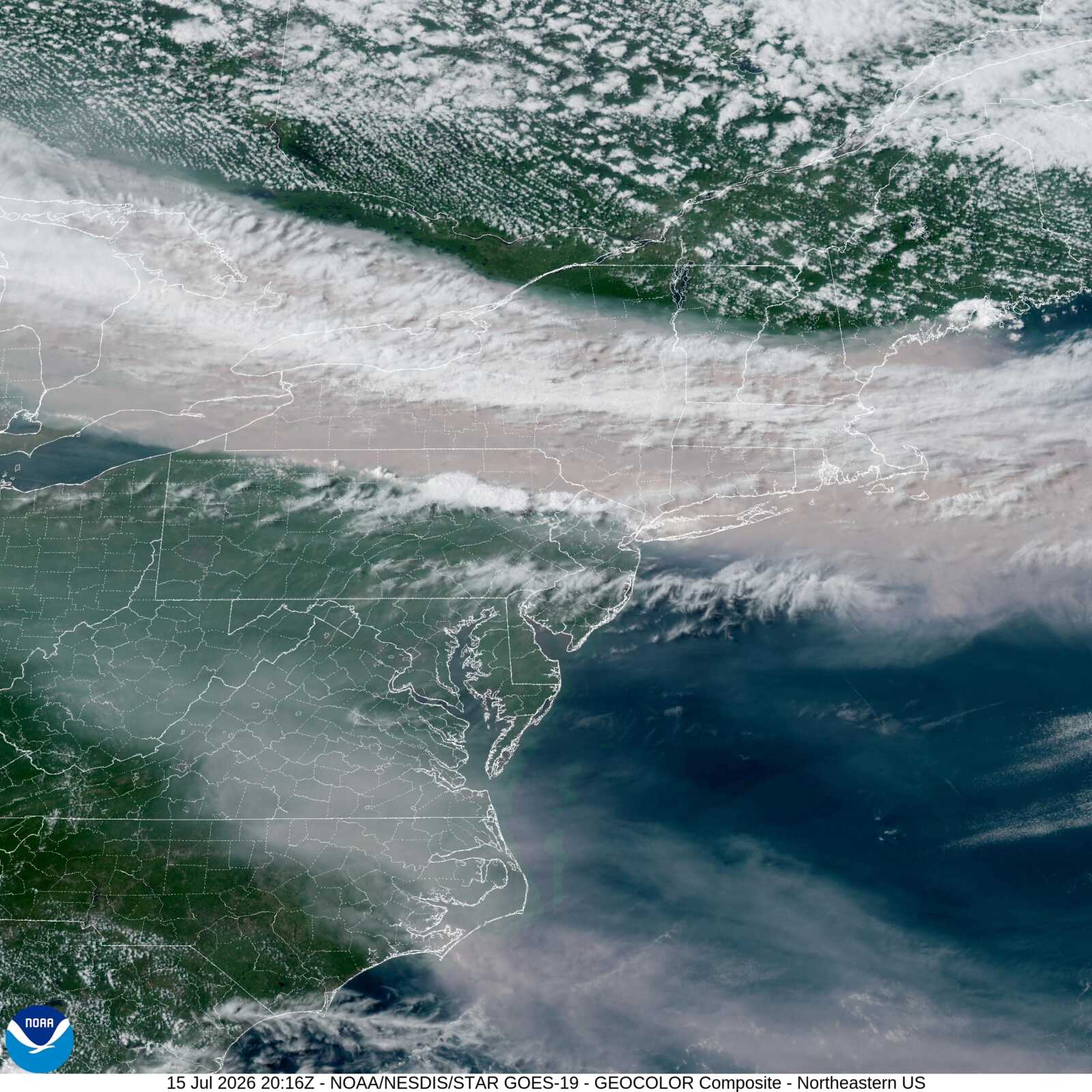
Areas of smoke from distant Canadian wildfires will linger over Northern Virginia today, creating hazy skies and continued hot conditions.
According to the National Weather Service Baltimore/Washington D.C. office, today will be mostly sunny with a high near 96. Heat index values could reach as high as 104 in spots. Winds will be light and variable. Areas of smoke are expected before noon.
Tonight
A slight chance of showers and thunderstorms is possible before 11 p.m., followed by a slight chance of showers between 11 p.m. and midnight (20% chance of precipitation). Areas of smoke will develop after 1 a.m. Partly cloudy skies with a low around 76. Winds will be calm, becoming north around 5 mph after midnight.
Friday
Areas of smoke will continue. Mostly sunny with a high near 93 and light north winds.
Friday Night
A chance of showers and thunderstorms develops after 2 a.m. (40% chance). Areas of smoke persist with increasing clouds and a low around 76. Southeast winds around 5 mph becoming calm after midnight.
Key Concerns: Heat, Smoke, and Air Quality
High heat and hazy skies are expected to continue through Friday. Forecasters opted against issuing a Heat Advisory today in coordination with neighboring offices. While temperatures remain hot, thick smoke from Canadian wildfires is limiting atmospheric mixing.
Smoke concentrations will increase today and Friday as additional plumes drift south from fires in Quebec and western Ontario. This is creating several more days of poor air quality.
Maryland and Virginia air quality agencies have issued Code Orange Air Quality Alerts for the D.C./Baltimore metro areas today, with more alerts likely Friday as conditions worsen. Residents sensitive to air quality — including children, the elderly, and those with respiratory conditions — should limit prolonged outdoor exertion.
Isolated showers and strong thunderstorms are possible this afternoon and evening, particularly near the Mason-Dixon line. The Storm Prediction Center has placed the region under a Marginal Risk (Level 1 of 5). Any storms that develop could bring damaging winds and brief large hail.
Thunderstorm chances increase this weekend as a front moves through the region. Saturday carries a Slight Risk (Level 2 of 5) for severe weather, with potential for damaging winds, hail, a few tornadoes, and flash flooding if sufficient instability develops.
Northern Virginia residents should stay hydrated, limit outdoor activity during peak heat, and check air quality indices before spending extended time outside. Wildfire smoke may continue to affect visibility and breathing comfort.