

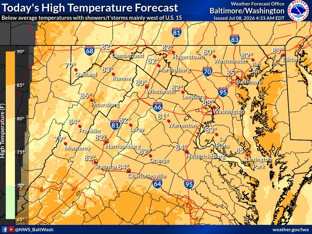
Residents across Northern Virginia should expect a mostly cloudy day with periods of showers on Wednesday, according to the National Weather Service (NWS) Baltimore-Washington, D.C. office. Low clouds, patchy fog, and isolated showers will dominate the morning hours.
High temperatures will remain below average for early July, generally reaching the upper 70s to low 80s in most spots, with a high near 84 possible in warmer locations. Winds will be light from the east at 3 to 5 mph. The chance of precipitation is around 30%, with most of the day’s convection expected to remain west of U.S. 15.
“Showers continue to develop in this post-frontal environment given sufficient instability,” the NWS noted. Dew points in the upper 60s to low 70s and precipitable water values around 1.75 to 2.00 inches are supporting sporadic shower development. The cells are disorganized and pose minimal flood risk.
Patchy fog, locally dense in the Shenandoah Valley and central Virginia Piedmont, could reduce visibility for morning commuters. Drivers are advised to use caution.
Tonight
Isolated showers and thunderstorms are possible before 2 a.m., becoming scattered showers between 2 and 5 a.m., then scattered showers and thunderstorms after 5 a.m. Lows will drop to around 70 under mostly cloudy skies, with light south winds. Precipitation chance remains near 30%.
Thursday and Beyond
Thursday will bring a much higher chance of showers and thunderstorms — 80% — especially after 4 p.m. Highs will reach near 88. New rainfall amounts of a tenth to a quarter inch are expected, with higher amounts possible in thunderstorms. The NWS highlights Marginal Risks for both severe weather and flash flooding on Thursday.
By Friday, the warmest day of the week, highs could return to the low 90s with continued afternoon and evening storm chances. A cold front will bring cooler, less humid conditions over the weekend, with highs in the low to mid-80s (cooler in the mountains), but daily chances of showers and thunderstorms will persist.
The forecast remains largely on track, with no significant changes from earlier outlooks. Residents in low-lying or flood-prone areas should stay alert for possible localized heavy rain later in the week.
