
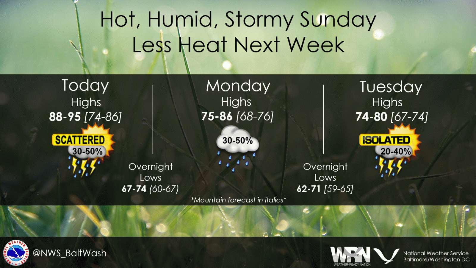
After several days of highs in the low to mid-90s, a cold front will bring a noticeable cool-down to our region. Showers and storms this evening will give way to cloudy skies and much cooler temperatures to start the week.
Highs will stay in the 70s to low 80s Monday and Tuesday, with some drizzle or light showers possible before drier weather returns midweek. By next weekend, warmer and more humid air will move back in, along with the chance for thunderstorms.
Meanwhile, in the Atlantic, Hurricane Erin continues to strengthen. While the storm is not expected to directly impact Virginia, it could generate rough surf and dangerous rip currents along the East Coast later this week.
Hurricane Erin Update (Sunday afternoon)
- Location: 21.3N 68.0W (about 235 miles NNW of San Juan, Puerto Rico; 200 miles east of Grand Turk Island)
- Maximum sustained winds: 125 mph (Category 3)
- Movement: West-northwest at 13 mph
- Minimum central pressure: 946 mb
The National Hurricane Center has issued Tropical Storm Warnings for the Turks and Caicos Islands and the southeast Bahamas. Erin is forecast to pass east of these islands tonight into Monday while maintaining major hurricane strength. Heavy rainfall, flash flooding, and dangerous surf are expected in the region. Swells from Erin will spread toward the Bahamas, Bermuda, and the U.S. East Coast in the coming days, creating life-threatening rip current risks.
Local Outlook for us in Northern Virginia:
- Sunday Night: Evening showers and storms ending by midnight. Patchy fog possible late. Lows mid-60s to mid-70s.
- Monday: Mostly cloudy, breezy, and cooler. Chance of light showers or drizzle. Highs mid-70s to low 80s.
- Tuesday: Clouds linger, with a stray shower possible. Highs in the 70s to near 80.
- Wednesday: Partly cloudy, mainly dry. Highs upper 70s to low 80s.
- Thursday & Friday: Seasonable and dry for most. Highs low to mid-80s, lows in the 60s.
- Saturday: Warmer, more humid, with a chance of afternoon storms. Highs mid-80s.
