
Hot, muggy weather continues Thursday, with another round of dangerous heat and the potential for flash flooding. Temperatures will reach the upper 80s to low 90s, but high humidity will make it feel more like 95–105 degrees. Scattered showers and thunderstorms are expected to develop by early afternoon, producing torrential downpours that could lead to significant flooding—especially in and around the I-66/US-50 corridor.
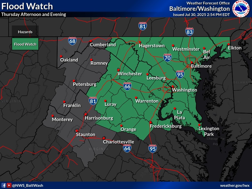
The National Weather Service has issued a Flood Watch from Thursday afternoon through late Thursday night for a wide area including the District of Columbia, most of central and southern Maryland, and northern Virginia. Some areas could see multiple rounds of storms with rainfall totals between 4 to 6 inches, causing extensive street flooding and flash flooding in poor drainage areas. Residents are urged to avoid travel during the evening commute and never drive through flooded roads.
Outlook:
- Thursday: Hot and humid; strong storms likely by afternoon with heavy rain and flash flooding possible. Flood Watch in effect from afternoon through late evening.
- Friday: Cooler with on-and-off showers; highs in the 70s.
- Friday Night: Drying out with lows in the 50s to low 60s.
- Saturday: Mostly sunny and pleasant; highs near 80.
- Sunday: Dry and seasonable with highs in the low 80s.