
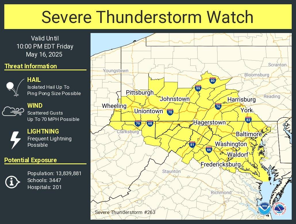
WOODBRIDGE, Va. – The National Weather Service has issued a Severe Thunderstorm Watch for much of Northern Virginia, in effect until 10 p.m. Friday, May 16, 2025.
Areas included in the watch are Prince William, Stafford, Fairfax, Fauquier, Culpeper, Loudoun, Frederick, and surrounding counties, along with the cities of Manassas, Manassas Park, Alexandria, Falls Church, Fairfax, and Winchester, according to the National Weather Service.
What to Expect
Earlier today, a line of moderate to heavy showers moved across central Maryland, bringing downpours but no severe weather. However, more storms could develop later this afternoon and evening, particularly along and east of I-95. With high humidity and temperatures reaching the upper 80s to near 90 degrees, conditions are favorable for strong to severe thunderstorms.
According to forecasters, this first round of potential storms may develop along Bay and River breezes, and if they do, they could bring damaging winds, large hail, and heavy rainfall. Another second round of storms is possible later tonight, depending on how systems develop to the west. While the overnight risk may be lower without daytime heating, humid air and an approaching cold front could still support severe weather into the early morning hours.
The Storm Prediction Center has placed the region under a Slight Risk for severe storms today and tonight. There’s also a Marginal Risk for excessive rainfall, meaning isolated flash flooding could occur, especially in areas that have already seen significant rain this week.
Weekend Outlook
A cold front is expected to move through on Saturday, bringing cooler and drier air. High pressure will build in from the north on Sunday and Monday, bringing calmer and more comfortable weather to the region.
Residents are encouraged to stay weather-aware, have multiple ways to receive alerts, and be prepared to take shelter if warnings are issued.