
Median Snow Totals by Region:
Fredericksburg:
- 6.5 inches
Manassas area:
- 9.5 inches
Prince William County:
- 7.8 inches
Stafford County:
- 7.8 inches
Spotsylvania County:
- 6.4 inches
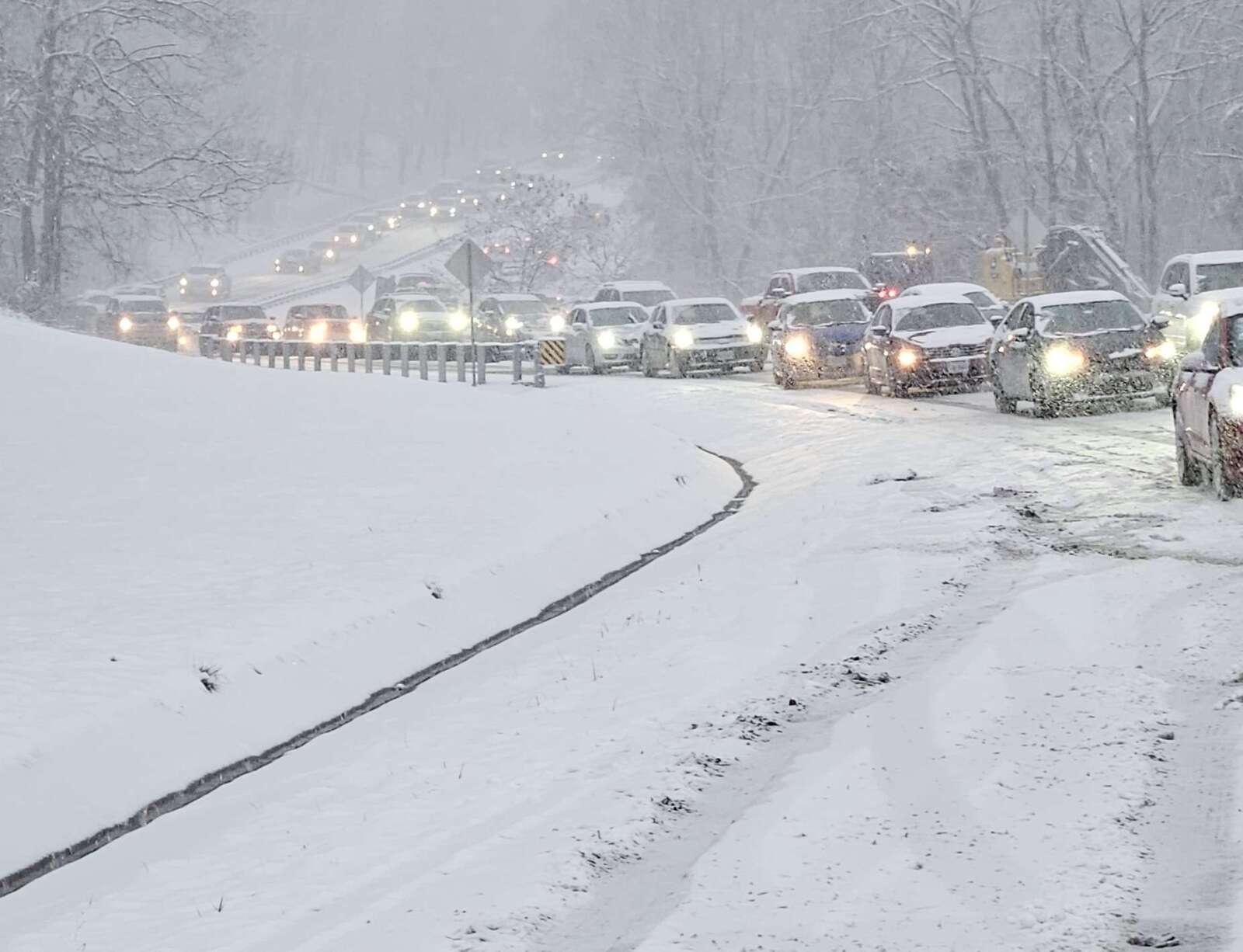
The heaviest snowfall totals were recorded in Manassas and parts of Stafford County, where accumulations neared 9.5 inches. Many roads across the region remain snow-covered and hazardous, prompting school closures and delays for Tuesday.
Weather Outlook and Forecast Discussion
According to the National Weather Service’s Baltimore-Washington Office, the region can expect a lull in precipitation through early Tuesday afternoon as a dry slot moves in. However, another low-pressure system is expected to bring additional wintry precipitation later today through tonight, primarily affecting areas near and west of the Blue Ridge Mountains.
“Expect a lull in precipitation through the early afternoon as a mid-level dry slot moves overhead. Another low-pressure system brings additional wintry precipitation late today through tonight,” the NWS forecast stated. “A cold front will cross the area Thursday afternoon, bringing blustery conditions. High pressure will build overhead Friday before another low-pressure system increases precipitation chances over the weekend.”
Near-Term Weather Impacts
While most of the snow has moved out of the area, lingering light rain and freezing rain may develop later today, depending on surface temperatures. The NWS has indicated that some areas may see a wintry mix before transitioning to rain overnight.
A strong push of warm air over the snowpack could also create widespread fog, reducing visibility to one mile or less in some locations. Dense fog advisories may be issued if conditions worsen.
Thursday and Friday Weather Outlook
Rain showers are expected to exit the region by early Thursday afternoon. However, colder air behind the departing storm system could result in snow showers over the mountains. Temperatures will rise into the 50s on Thursday before another cold front moves through, bringing gusty winds up to 30 mph.
By Thursday night, high pressure will settle in, ushering in much colder temperatures heading into the weekend. The NWS warns of another potential storm system bringing precipitation over the weekend, though details remain uncertain.
