
Updated – The National Weather Service (NWS) Baltimore-Washington office has issued a Winter Storm Watch for the region, warning of heavy snowfall and hazardous travel conditions from Tuesday afternoon through Wednesday morning.
Snowfall Forecast & Timing
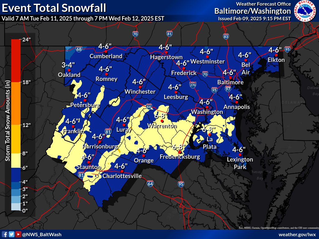
Forecasters predict four to six inches of snow, with some areas possibly receiving higher totals.
- Tuesday Afternoon: Light snow begins across the region.
- Tuesday Evening into Overnight: Snowfall intensifies, becoming steady and heavy at times.
- Wednesday Morning: Additional wintry precipitation is possible before tapering off.
Impact on Travel & Commutes
The Tuesday evening and Wednesday morning commutes could be significantly impacted due to slippery and snow-covered roads. Drivers are urged to exercise caution and prepare for reduced visibility and potential delays.
Midweek & Weekend Weather Outlook
The active weather pattern will continue through the week:
- Wednesday: Snow transitions to a wintry mix, with freezing rain likely in areas west of the Blue Ridge Mountains and a rain/snow mix possible east of the mountains.
- Weekend: Another storm system may bring heavy rain or a wintry mix, increasing the risk of flooding as rain falls on a snow-covered landscape.
How Much Snow Will Fall? Guess & Win!
Think you can predict the total snowfall? Comment with your guess for the official snowfall recorded at Reagan Washington National Airport.
The first correct guess posted by 11:59 p.m. on Monday, February 10, 2025, wins a prize! The winner will be announced later this week.
