
 Today’s weather forecast is sponsored by Water’s End Brewery. Sometimes all you need is a Damn Beer. Take 96oz of this crisp, Golden Ale brewed fresh by Water’s End Brewery to-go with you in a 6-Pounder for just $14.99!
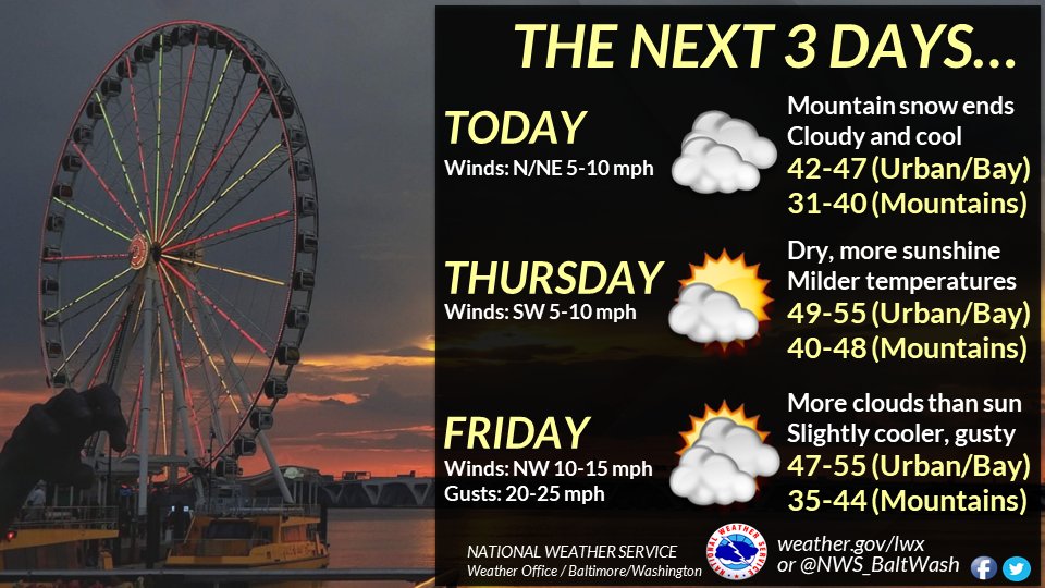
Summary of the weather forecast from the National Weather Service:
- An upper-level low and associated surface low pressure/cold front are crossing the central and southern Appalachians.
- A cloud shield associated with the low is causing a few sprinkles or flurries in the Mid-Atlantic region.
- Measurable precipitation and accumulating snowfall are limited, with a drying trend expected as the low moves offshore.
- Lingering moisture may result in a few sprinkles or flurries into the early afternoon, especially along/west of the Allegheny Front.
- Temperatures will be near to slightly above normal, with highs in the 40s (30s over mountains) and lows in the 30s (20s in sheltered valleys and over higher terrain).
- Some patchy fog is possible in areas where low-level moisture lingers and clouds break.
Extended Forecast:
- Wednesday: Scattered sprinkles before 1 pm, mostly cloudy, with a high near 47. Calm wind becoming northeast around 5 mph in the morning.
- Wednesday Night: Mostly cloudy, with a low around 32. Light and variable wind.
- Thursday: Mostly sunny, with a high near 54. Southwest wind 3 to 7 mph.
- Thursday Night: Mostly cloudy, with a low around 38. Calm wind becoming northwest around 5 mph after midnight.
- Friday: Partly sunny, with a high near 52.
