
 Today’s weather forecast is sponsored by Water’s End Brewery. Sometimes all you need is a Damn Beer. Take 96oz of this crisp, Golden Ale brewed fresh by Water’s End Brewery to-go with you in a 6-Pounder for just $14.99!
National Weather Service Baltimore-Washington: The area will experience a shift in weather patterns as high pressure moves away, allowing a trough to establish over the southwestern part of the country. Throughout the week, multiple disturbances within southwesterly flow aloft will bring changes, with the possibility of a stronger low-pressure system crossing the area over the weekend.
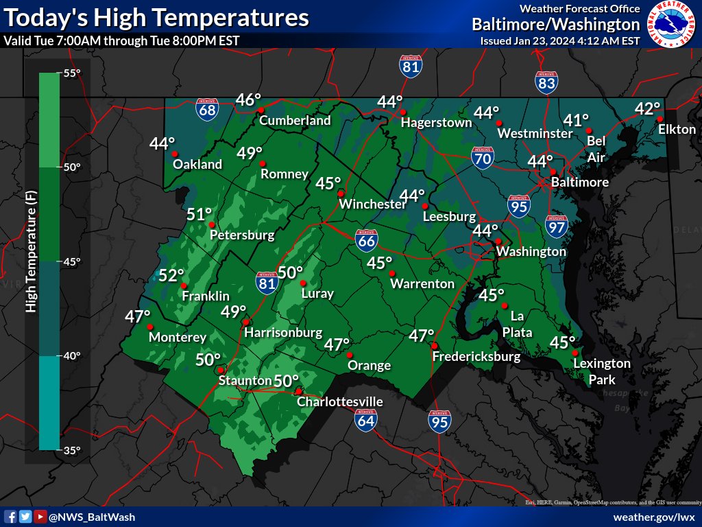
In the near term, due to high pressure, dry conditions will persist for the rest of the day. However, warm advection precipitation near the Great Lakes and thickening mid-level and high clouds are expected. Some areas, including east of Charlottesville, south of Fredericksburg, and north of Richmond, will experience more sunshine than clouds. Despite increasing clouds, temperatures will continue to warm, reaching the 40s (nearing 50 in the southwest).
Tonight’s forecast brings the potential for light showers in areas near freezing. There is low confidence regarding the possibility of freezing drizzle or freezing rain in the northwest and north-central zones. Models show varying scenarios, with some indicating a dry night and others suggesting light showers confined to specific regions. Temperature predictions also vary, with some areas expecting lows near or below freezing. The possibility of freezing rain is minimal, mainly in northern parts of the area. Ground temperatures from the recent cold snap may contribute to hazardous conditions for Wednesday morning’s commute.
