
From the National Weather Service:
…FREEZE WARNING IN EFFECT FROM MIDNIGHT TONIGHT TO 9 AM EST MONDAY…
* WHAT…Sub-freezing temperatures around 28 to 32 degrees expected.
* WHERE…Portions of central, northeast, and southern Maryland, The District of Columbia and northern Virginia.
* WHEN…From midnight tonight to 9 AM EST Monday.
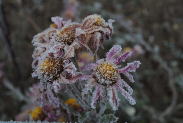
* IMPACTS…Freeze conditions will kill crops, other sensitive vegetation and possibly damage unprotected outdoor plumbing.
PRECAUTIONARY/PREPAREDNESS ACTIONS…
Take steps now to protect tender plants from the cold. To prevent freezing and possible bursting of outdoor water pipes they should be wrapped, drained, or allowed to drip slowly. Those that have in-ground sprinkler systems should drain them and cover above- ground pipes to protect them from freezing.
Today
Mostly cloudy through mid-morning, then becoming sunny, with a high near 52. Northwest wind 10 to 16 mph, with gusts as high as 26 mph.
Tonight
Clear, with a low of around 33. Northwest wind 6 to 11 mph, with gusts as high as 20 mph.
Monday
Sunny, with a high near 49. North wind 3 to 7 mph.
Monday Night
Mostly clear, with a low around 32. Light northeast wind.
Tuesday
Rain is likely after 1 pm. Mostly cloudy, with a high near 47. East wind 3 to 6 mph. The chance of precipitation is 70%.
Tuesday Night
Rain. Low around 40. The chance of precipitation is 90%.
Wednesday
Partly sunny, with a high near 54.
Conditions will be much chillier to finish the weekend. Expect high temps in the mid 40s-low 50s (30s across the mountains). Brisk NW winds will accompany these chilly temps. For tonight, a Freeze Warning is in effect from midnight-9 AM for areas along and east of I-95. pic.twitter.com/57nPoMb0H6
— NWS Baltimore-Washington (@NWS_BaltWash) November 13, 2022