
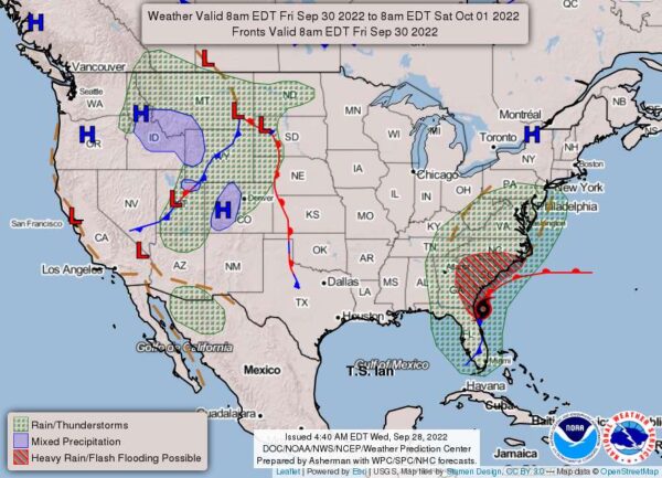
Right now, the Natioanl Weather Service warns locaalties south of Fredericksburg to expect heavy rain. The hazerdous weather advisroy could expand into more northelry jurisdcitions as Hurricane Ian makes its way up the east coast.
Hurrican Ian is forecasted to make a second landfall near the Georgia / South Carolina border Friday afternoon before moving northwest and weakening over the Carolinas Saturday. Meanwhile, strong high pressure will remain in New England into the weekend.
The high to the north and the tropical low to the south will funnel moisture into the region, with periods of heavy rain possible Friday night through the weekend.
At 2 p.m. Wednesday, September 28, the eye of Hurricane Ian was located by an Air Force Reserve Hurricane Hunter aircraft and Tampa radar data near latitude 26.6 North, longitude 82.3 West, near Fort Meyers, Fla. Ian is moving toward the north-northeast near nine mph. This general motion with a reduction in forward speed is forecast today, followed by a turn toward the northeast on Thursday.
On the forecast track, the center of Ian is expected to move onshore soon, over central Florida tonight and Thursday morning, and emerge over the western Atlantic by late Thursday.