
After morning frost across the region this morning, the risk of fire will prevail today as temperatures and wind speeds increase.
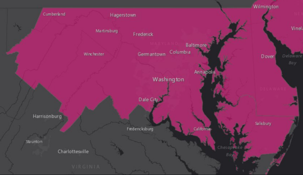
A Red Flag Warning is in effect today between 10 a.m. and 8 p.m., according to the National Weather Service. Winds gusting up to 35 mph coupled with low relative humidity will make for favorable fire conditions.
A house on Shelton Shop Road in Stafford burned on April 12, the last day a Red Flag Warning had been issued. While outdoor burning is banned today due to the warning, Virginia law prevents outdoor burning until after 4 p.m. February 15 to April 30 each year.
Red Flag Warning for most of MD, eastern WV and northern/central VA from 10 AM-8 PM. Dry and windy conditions will create an environment conducive for the rapid spread of wildfires. All outdoor burning is discouraged today. pic.twitter.com/Yx9N3e1nqp
— NWS DC/Baltimore (@NWS_BaltWash) April 30, 2018
Today will be warmer than yesterday’s high in the mid to upper 50s with temperatures on Monday reaching into the low 70s. High pressure to the south will keep skies mostly clear, but bring low temperatures landing between 35 and 50 degrees, according to the weather service.
The warming trend continues on Tuesday with dry conditions and sunshine that will help high temperatures reach near 80 with lows in the 50s Tuesday night. On Wednesday, expect sunny skies and highs in the mid-80s with lows in the 60s Wednesday night.
By Thursday, we can start using the word “hot” in the forecast with temperatures expected to reach 90 degrees for the first time so far this year. A high-pressure system off the North Carolina coast will help usher in the hot temperatures, according to the weather service.
Temperatures will be a bit cooler on Friday with highs in the 80s. There is a chance of rain showers Friday night into Saturday morning. Rain showers are also a possibility for Sunday, however, forecasters are uncertain about how much rain we might see.
