
From the National Weather Service:
“DAY ONE…Today and Tonight Patchy frost is possible tonight, primarily away from the urban areas and away from the tidal waters. .DAYS TWO THROUGH SEVEN…Tuesday through Sunday Patchy frost is possible Tuesday night into Wednesday morning, primarily away from the urban areas and away from the tidal waters.
SHORT TERM /6 PM THIS EVENING THROUGH WEDNESDAY NIGHT/… After this evening, it`s mainly a temperature forecast through the middle of the week, with attention paid to frost/freeze concerns. High pressure will move in from the west tonight and then remain directly over the region through the middle of the week. Clouds will be minimal and winds light.
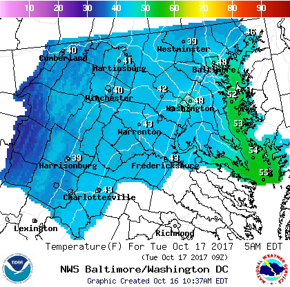
Have trended forecast toward colder guidance for overnight lows given what should be fairly good radiational cooling conditions. Tonight may be a little tricky since some wind is likely to linger, but it does look like calmer conditions are likely toward dawn. A Freeze Watch will be in effect for portions of the highlands tonight. Would not be surprised if there were some pockets of near-freezing temperatures in the rest of the western valleys as well. Will let the day shift determine which areas will need a Frost Advisory, with locations west of the Blue Ridge looking most favorable.
Temperatures will gradually moderate through the middle of the week, but not before another potential frost/freeze for outlying areas Tuesday night. Daytime highs will remain in the 60s Tuesday, but inch into the 70s for some areas on Wednesday.”