
 Today’s weather forecast is sponsored by Water’s End Brewery. Sometimes all you need is a Damn Beer. Take 96oz of this crisp, Golden Ale brewed fresh by Water’s End Brewery to-go with you in a 6-Pounder for just $14.99!
The National Weather Service forecasts a weakening cold front crossing the region today, followed by another wave of low pressure in the Mid-Atlantic over the weekend. High pressure is expected to return early next week.
Today and Saturday will see well above normal temperatures, cooling conditions are anticipated on Sunday into the next week. An area of low pressure over the Ohio River valley will move northeast, bringing a warm front overhead and a subsequent cold front that will stall to the south in the evening.
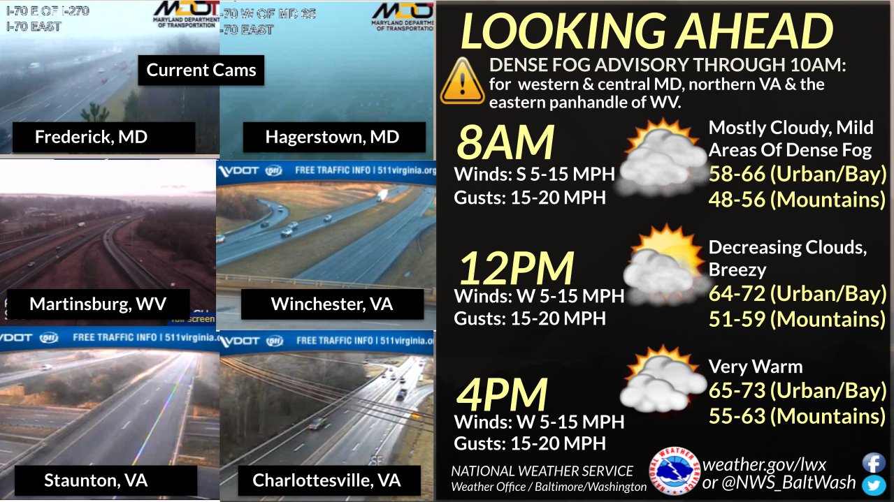
Dense Fog Advisories are in effect, but they will lighten up by late morning, with mainly dry conditions in the afternoon.Temperatures will be well above normal, reaching highs in the upper 60s to low 70s, and overnight lows will cool to the 40s across the area.
Today
Partly sunny, with a high near 73. Southwest wind 7 to 9 mph, with gusts as high as 20 mph.
Tonight
Mostly cloudy, with a low of around 45. North wind 5 to 7 mph.
Saturday
Rain, mainly after 4pm. High near 58. North wind 3 to 6 mph. Chance of precipitation is 80%. New precipitation amounts of less than a tenth of an inch possible.
Saturday Night
Rain. Low around 42. East wind around 7 mph. The chance of precipitation is 100%. New precipitation amounts between a half and three-quarters of an inch possible.
Sunday
Rain. High near 48. North wind 7 to 10 mph. The chance of precipitation is 90%.
