
 Today’s weather forecast is sponsored by Water’s End Brewery. Serving fresh craft beer at four taprooms located throughout Northern Virginia! Visit us today to grab a flight and take some fresh craft beer with you to go!
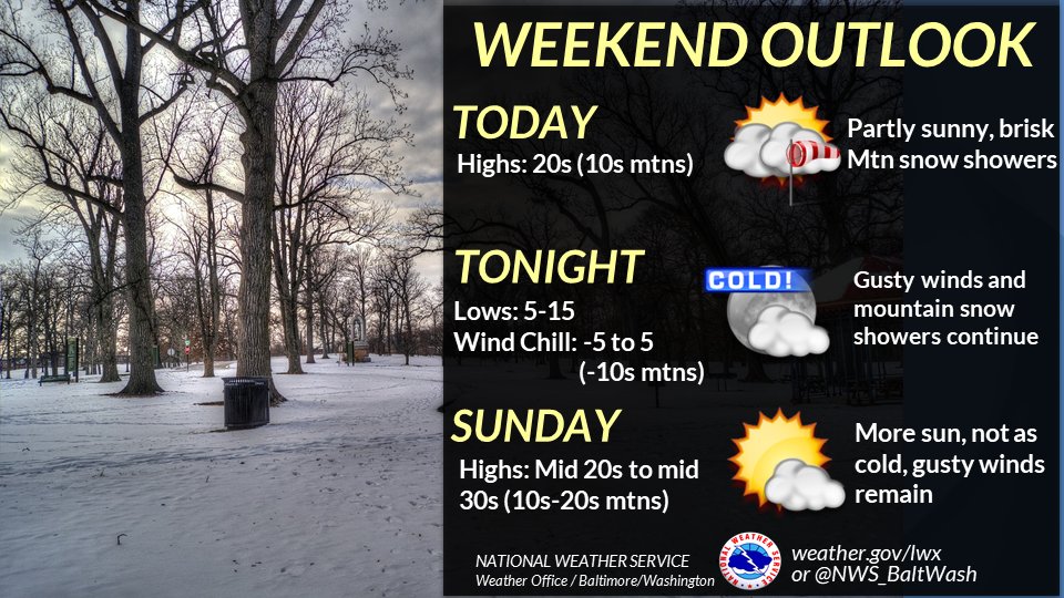
The National Weather Service reports ongoing cold temperatures and snow showers, particularly along the Allegheny Front.
The atmosphere remains conducive to occasional streamers making their way east of the mountains. Currently, one such streamer has reached Fairfax County, albeit weakening. Despite this, it still holds some intensity and may drop another couple of tenths of an inch of snowfall for those under the heaviest portion. Additionally, some light snow showers continue in northeast Maryland, with another couple of tenths of an inch possible.
The final piece of shortwave energy is yet to fully push through the region, anticipated later today into tonight. Snow showers over the mountains will persist during this period, although the intensity is expected to let up compared to the previous evening and overnight hours.
East of the mountains, snow activity is expected to diminish. However, there is some indication of streamers to the north. While this remains a possibility, the current expectation is for the region to mostly escape additional snowfall. Nevertheless, close monitoring of the situation is advised.
While Wind Chill Headlines are not in effect further east, it will still be dangerously cold from this morning through Sunday morning. Gusty winds are expected to develop today, and with highs only in the 20s, most areas won’t see wind chills above the lower teens today, dipping to near 0 tonight. Residents are urged to exercise caution and take necessary precautions to stay safe in these extreme cold conditions.
