
Starting today and lasting through the weekend, we’re in for some of the hottest weather we’ve seen in these parts in years.
A heat advisory goes into effect on Wednesday as the mercury is expected to climb into the middle 90s, pushing up heat index values around the region above the century mark.
On Thursday, it’s much of the same story.
But on Friday, expect actual high temperatures to hover near the 100-degree mark, with heat index values soaring higher.
On Saturday, we top it, with a high forecast high temperature of 101 degrees. Sunday is not much cooler with a high of 99.
It’ll be a relatively cooler 92 degrees on Monday.
Here’s what you need to know today from the National Weather Service:
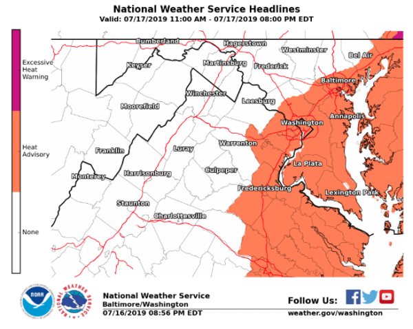
HEAT ADVISORY IN EFFECT FROM 11 AM TO 8 PM EDT WEDNESDAY…
The National Weather Service in Baltimore MD/Washington has issued a Heat Advisory, which is in effect from 11 AM to 8 PM EDT
Wednesday.
* HEAT INDEX VALUES…Around 105 degrees with temperatures in the middle 90s and dewpoints in the lower to middle 70s.
* IMPACTS…The heat and humidity may cause heat stress during outdoor exertion or extended exposure.
PRECAUTIONARY/PREPAREDNESS ACTIONS…
A Heat Advisory means that a period of high temperatures is expected. The combination of high temperatures and high humidity will create a situation in which heat illnesses are possible.
Take extra precautions if you work or spend time outside. When possible, reschedule strenuous activities to early morning or
evening. Know the signs and symptoms of heat exhaustion and heat stroke. Wear light weight and loose fitting clothing when possible and drink plenty of water.
To reduce risk during outdoor work, the Occupational Safety and Health Administration recommends scheduling frequent rest breaks in shaded or air conditioned environments. Anyone overcome by heat should be moved to a cool and shaded location. Heat stroke is an emergency – call 911.