

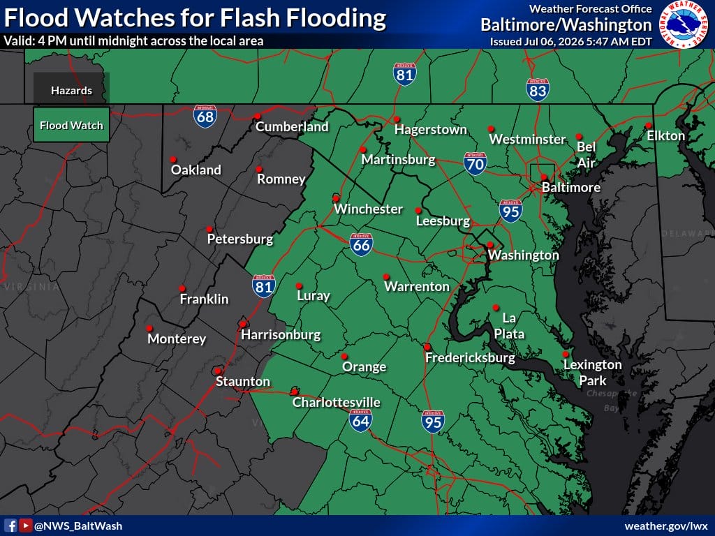
FLOOD WATCH REMAINS IN EFFECT from 4 PM EDT this afternoon through this evening for Washington DC, much of Maryland, Northern Virginia, and eastern West Virginia.
The National Weather Service Baltimore MD/Washington DC has warned of an increased risk of flash flooding this afternoon and evening due to a slow-moving frontal zone and tropical air mass in place.
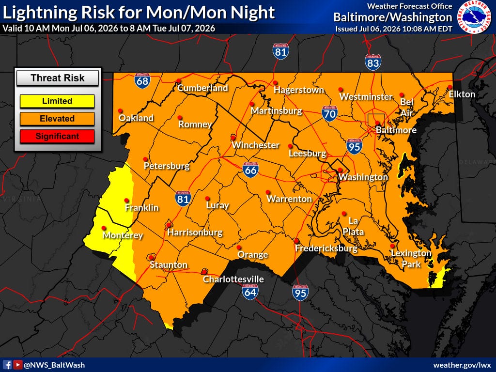
Multiple rounds of heavy rainfall are possible, with slow storm motions leading to repeat thunderstorm activity. Hourly rainfall rates could reach 2 to 3 inches in the strongest storms, and up to an inch in just 20 minutes is possible in some cells. Areas that recently experienced flooding are at particular risk.
Areas Affected
Includes Stafford, Spotsylvania, Prince William (including Manassas/Manassas Park), Fairfax, Loudoun, Fauquier, Culpeper, Orange, and many other Northern Virginia localities, as well as Washington, DC, and surrounding Maryland counties.
Impacts
- Flash flooding of rivers, creeks, streams, and low-lying areas
- Flooding in urban areas and locations with poor drainage
- Excessive runoff from repeated heavy downpours
Forecast
Today: Partly sunny with a high near 93. Heat index values as high as 103. Showers and thunderstorms likely, mainly after 5 PM (60% chance). New rainfall amounts generally less than a tenth of an inch, except higher amounts possible in thunderstorms.
Tonight: Showers and thunderstorms likely before 2 AM, then scattered showers. Some storms could produce heavy rainfall. Low around 70. Chance of precipitation 70%. Patchy fog possible after 11 PM. Rainfall amounts between a half and three-quarters of an inch possible.
Tuesday: Mostly cloudy with a high near 86. Chance of showers and thunderstorms, especially after 5 PM (60% chance). Patchy fog in the morning.
Safety Tips
Avoid driving through flooded roads — “Turn Around, Don’t Drown.” Monitor streams and low-lying areas. For more flood safety information, visit weather.gov.
