
 Updated 2:20 p.m: The National Weather Service has issued a Winter Weather Advisory for Prince William County and surrounding areas from 10 a.m. to 7 p.m. on Saturday, Feb. 8, 2025.
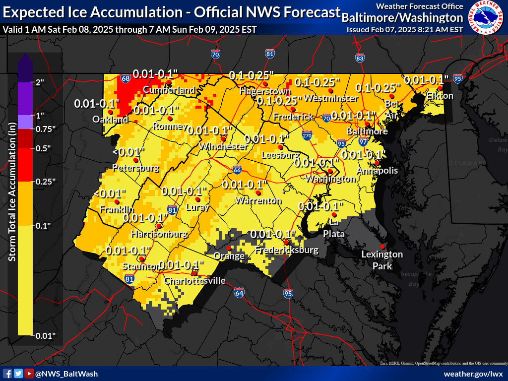
A wintry mix of precipitation is expected, with snow and sleet accumulations up to 1 inch and ice accumulations up to one-tenth of an inch. The advisory covers the District of Columbia, central Maryland, and central and northern Virginia.
Precipitation will overspread the area Saturday morning, starting as snow. By the afternoon, it will transition to sleet and freezing rain, creating hazardous travel conditions. By the evening, temperatures will rise, changing the precipitation to cold rain, which may help reduce ice accumulation but could leave roads slick.
While temperatures will hover near freezing, the combination of snow, sleet, and freezing rain will create slippery roads and difficult driving conditions throughout the day. If you must travel, exercise caution and allow extra time to reach your destination.
The storm will taper off early Sunday, except for lingering snow showers in the Allegheny Mountains. A refreeze is possible overnight as temperatures drop into the upper 20s to near freezing.
Sunday will bring a brief break from wintry weather, with highs in the mid-40s to low-50s north of I-66 and upper-50s further south. However, strong northwesterly winds with gusts up to 35 mph will make for a blustery day.
Monday is expected to be calm but cloudy, with highs in the upper 30s and low 40s. Another potential storm system may develop Tuesday through Thursday, but forecast details remain uncertain.
