
The region will be under a high wind watch Saturday, April 1, 2023, from noon until midnight.
From the National Weather Service:
…HIGH WIND WARNING IN EFFECT FROM NOON SATURDAY TO MIDNIGHT EDT
SATURDAY NIGHT…* WHAT…Southwest winds 20 to 30 mph with gusts up to 50 mph
Saturday afternoon, becoming northwest 25 to 35 mph with gusts
up to 60 mph Saturday evening.* WHERE…Portions of central and northern Maryland, The District
of Columbia, and northern Virginia.* WHEN…From noon Saturday to midnight EDT Saturday night. The
strongest winds are expected Saturday evening.* IMPACTS…Damaging winds will blow down trees and power lines.
Widespread power outages are expected. Travel will be difficult,
especially for high profile vehicles.PRECAUTIONARY/PREPAREDNESS ACTIONS…
People should avoid being outside in forested areas and around
trees and branches. If possible, remain in the lower levels of
your home during the windstorm, and avoid windows. Use caution if
you must drive.
The forecast:
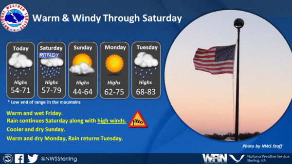
Saturday
Showers are likely, mainly before 11 am. Cloudy, then gradual clearing during the afternoon, with a high near 77. Breezy, with a southwest wind 18 to 24 mph, with gusts as high as 44 mph. Chance of precipitation is 70%. New precipitation amounts between a tenth and quarter of an inch possible.
Saturday Night
Partly cloudy, with a low of around 42. Windy, with a northwest wind 25 to 30 mph decreasing to 16 to 21 mph in the evening. Winds could gust as high as 55 mph.
Sunday
Sunny, with a high near 58. Northwest wind 11 to 17 mph, with gusts as high as 28 mph.
Sunday Night
Clear, with a low of around 40.
Monday
Sunny, with a high near 73.
The High Wind Watch has been expanded farther east to include the Baltimore and Washington metro areas and north central MD for increased potential for damaging winds Saturday through Saturday evening. #DCwx #MDwx #VAwx #WVwx pic.twitter.com/JbAzdV2hJp
— NWS Baltimore-Washington (@NWS_BaltWash) March 31, 2023