Five years after its debut, the Diverging Diamond Interchange (DDI) at Exit 140 on Interstate 95 in Stafford County has reshaped traffic patterns, boosted capacity, and contributed to regional growth.

This one’s for the people who really care about local news.

Locals Only members get deeper reporting, more context, and fewer shortcuts.

Think that’s you?
👉 Join Locals Only
Already a member? Sign in


Construction has begun on the Wellington Road Shared Use Path, a long-awaited project aimed at closing a crucial gap in the city’s pedestrian and bicycle network. The new path will run along Wellington Road from Nokesville Road to Prince William Street, offering a safer and more convenient route for cyclists and pedestrians.

The project, designated as Wellington Road Shared Use Path Gap, will construct an 1,800-foot trail segment in a single phase. With a total budget of $1.3 million, the project covers design, right-of-way acquisition, construction, and necessary railroad agreements. M&F Concrete, Inc. has been awarded the contract to carry out the work.


As Stafford County leaders push forward with plans for a Western Road Network to relieve congestion west of Interstate 95, tensions continue to rise over the future of a proposed Rappahannock River crossing.

This one’s for the people who really care about local news.

Locals Only members get deeper reporting, more context, and fewer shortcuts.

Think that’s you?
👉 Join Locals Only
Already a member? Sign in


Prince William County Supervisor Yesli Vega has issued a directive to widen Route 28 from four to six lanes between the Manassas City Line and the Fairfax County Line, marking a significant shift in the county’s approach to alleviating traffic congestion.

This one’s for the people who really care about local news.

Locals Only members get deeper reporting, more context, and fewer shortcuts.

Think that’s you?
👉 Join Locals Only
Already a member? Sign in


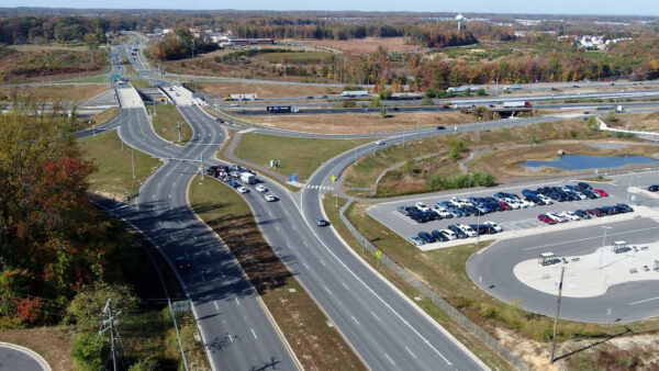
The Virginia Department of Transportation (VDOT) is seeking feedback from residents and travelers on a Strategically Targeted Affordable Roadway Solutions (STARS) study assessing potential safety, operational, transit, and bicycle/pedestrian improvements along Hoadly Road (Route 642) between Route 234 (Dumfries Road) and Prince William Parkway (Route 294).

Hoadly Road, a key corridor in Prince William County, carries an average of 25,000 vehicles per day with a posted speed limit of 50 mph. The STARS study aims to identify potential improvements to enhance traffic flow, increase safety, and support multimodal transportation in the area.


The Prince William County Department of Transportation (PWDOT) has released its FY2024 Annual Report, outlining major infrastructure improvements, safety initiatives, and upcoming projects that aim to enhance the county’s multi-modal transportation network.

This one’s for the people who really care about local news.

Locals Only members get deeper reporting, more context, and fewer shortcuts.

Think that’s you?
👉 Join Locals Only
Already a member? Sign in


The Haymarket Police Department has launched a new initiative to collect and analyze traffic volume data to enhance road safety and improve traffic management in town.

During the Haymarket Town Council meeting on February 3, 2025, Police Chief Allen Sibert shared findings from a speed sign installed on the eastbound lane of Washington Street, the town’s main thoroughfare. The data collected over the past six months revealed that the highest volume of traffic occurs during lunchtime hours, surpassing even the traditional rush hour periods.

“This data is invaluable as it allows us to better understand traffic patterns and adjust enforcement efforts accordingly,” said Chief Sibert. “We want to ensure our roads remain safe and that we are using our resources where they are most needed.”

This one’s for the people who really care about local news.

Locals Only members get deeper reporting, more context, and fewer shortcuts.

Think that’s you?
👉 Join Locals Only
Already a member? Sign in


Fredericksburg is taking another step forward to become a more walkable community with the recent start of construction off LaFayette Boulevard, which is part of the city’s Twin Lake Drive and Kensington Pedestrian Connector project.

This $2.4 million project includes extending a 10-foot wide paved shared-use path along the north side of Lafayette Boulevard between Twin Lake Drive and St. Paul Street in the City of Fredericksburg. The path will be accessible, with ramps and crosswalks built where the route intersects with Twin Lakes Drive, Springwood Drive, Kensington Place, and St. Paul Street.

The project includes a paved access point to the Virginia Central Railway Trail from the cul-de-sac of Springwood Drive, and a bike repair station will be installed at Alum Spring Park.

This one’s for the people who really care about local news.

Locals Only members get deeper reporting, more context, and fewer shortcuts.

Think that’s you?
👉 Join Locals Only
Already a member? Sign in


View More Stories