
When it comes to the clipper system that is supposed to bring snow showers to our region Wednesday, how much snow accumulation we see – if any at all in Prince William and Stafford counties – all depends on the temperatures.
Snow showers are expected to develop about midday Wednesday bringing one to two inches of snow the region, but mainly to the northern Washington, D.C. suburbs in western Virginia and western Maryland. Our area could see less than an inch of accumulation, according to the National Weather Service.
What snow that does fall could mix with rain by Wednesday afternoon. That’s because temperatures are forecasted to climb out of the 20s and into the low 30s, above the freezing mark.
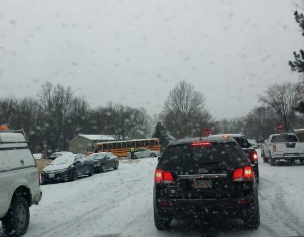
When a clipper system moved across the region on Jan. 6 – the storm that left several school buses stranded on snow covered roads and spelled nightmarish driving conditions on major thoroughfares and side streets – came as temperatures were in the 20s, well cold enough for the storm to produce snow and to freeze on the ground upon contact with the surface.
This incoming storm system “will likely interfere with travel Wednesday,” according to the weather service.
As the storm moves out Wednesday, temperatures will drop into the 20s and some leftover precipitation is possible, according to the weather service.
Thursday will bring some clouds to the area, but the forecast calls for mostly sunny skies with highs in the mid-40s and lows in the upper 20s. Friday will bring mostly sunny skies with high temperatures in the low 40s and lows in the upper 20s.