
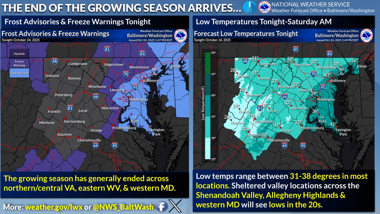
Clear skies and calm winds tonight will set the stage for a chilly night across the region, with frost and freezing temperatures expected for many areas west of I-95.
High pressure will keep the weekend mainly dry and seasonably cool, but clouds will gradually increase by Sunday as the next weather system approaches from the Midwest.
Rain chances look to return early next week as low pressure moves in from the Mississippi Valley.
Outlook:
- Tonight: Mostly clear with patchy frost developing after midnight; lows near the mid-30s.
- Saturday: Sunny and cool; highs around 60°. Patchy frost early in the morning.
- Saturday Night: Mostly cloudy and calm; lows near 40°.
- Sunday: Increasing clouds but remaining dry; highs near 59°.
- Sunday Night: Mostly cloudy with a few late-night showers possible; lows in the mid-40s.
