
 Prince William Parks and Recreation sponsors today’s weather forecast.
Summer Job Alert: Parks and Recreation Hiring Seasonal Workers Now! Want to earn some extra cash this summer and enjoy your job at the same time? PWC Parks and Recreation is now hiring for seasonal jobs, Camp Counselors, Lifeguards, Cooks, and more…
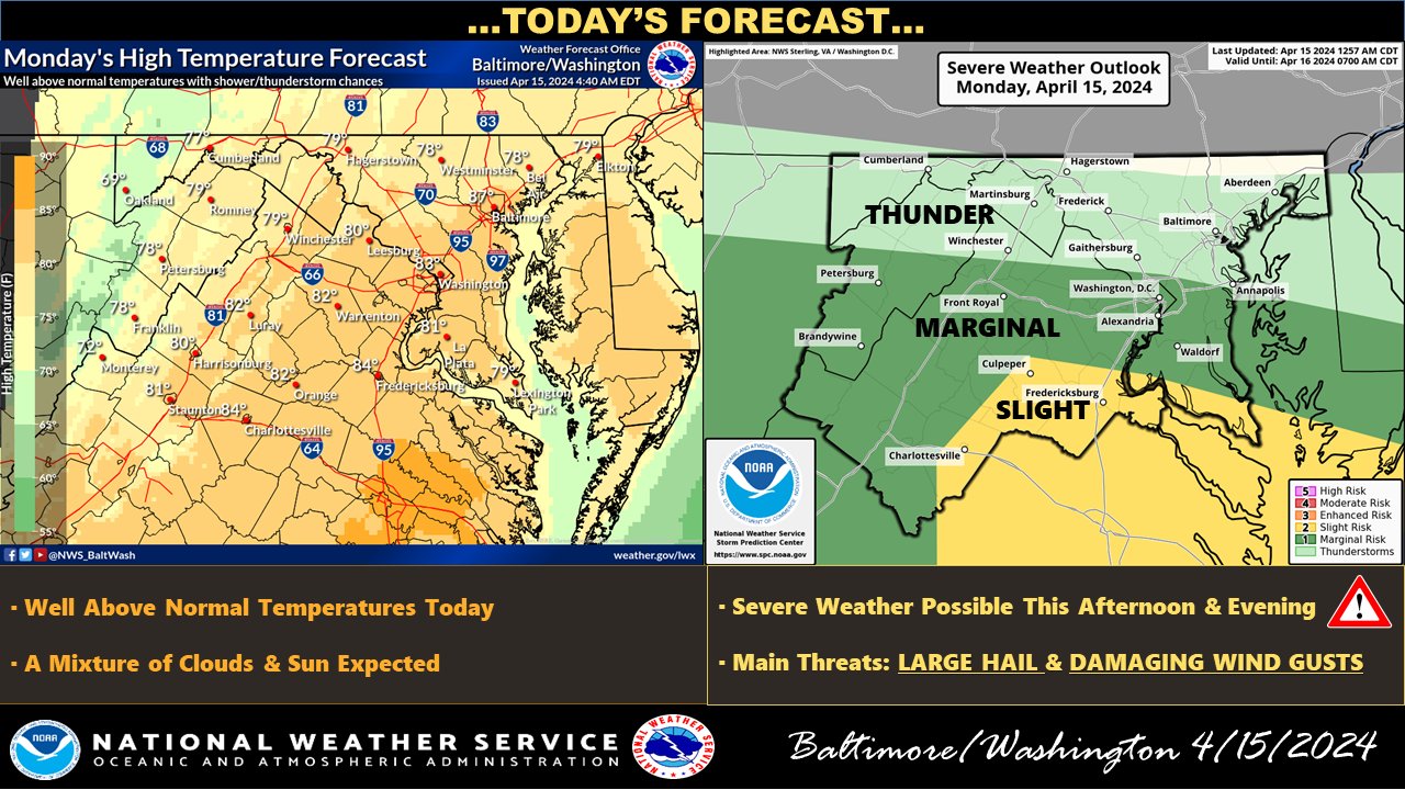
We should remain weather-aware today as the National Weather Service predicts the possibility of severe thunderstorms later today. Showers and a few thunderstorms have been drifting southeastward across the northern half of the forecast area early this morning. Although this activity is expected to weaken and dissipate prior to daybreak, clouds may linger into the first half of the morning.
A cold front will slowly move southward across the region, creating conditions conducive to the development of thunderstorms this afternoon. Daytime heating will contribute to instability. Thunderstorms will likely develop, primarily south of I-66/US-50 and east of US-15.
While the exact locations where thunderstorms will form are uncertain, any area within the forecast region has at least a slight chance of experiencing thunderstorms. However, areas further west may experience limited storm coverage due to downsloping winds drying out the boundary layer. In contrast, areas further north may see fewer storms due to limited low-level convergence.
The storms that do develop are expected to be vital to severe. Model soundings suggest an environment more typical of the High Plains than the Mid-Atlantic, with steep lapse rates and the potential for damaging winds and hail. While tornadoes are not expected due to the dry boundary layer and minimal low-level shear, residents should remain vigilant as severe weather can quickly develop.
The I-95 corridor south of D.C. to southern Maryland stands the greatest chance of experiencing severe storms. These storms are forecasted to progress to the south and east this evening, leading to overnight dry conditions.
As the weather pattern evolves into Tuesday and Wednesday, a narrow ridge of high pressure will build overhead, bringing primarily sunny conditions on Tuesday with a high near 76. However, residents should remain vigilant as a weak band of warm advection aloft may cause showers and thunderstorms to develop, primarily to the west of the Blue Ridge.
