
 Prince William Parks and Recreation sponsors today’s weather forecast.
Summer Job Alert: Parks and Recreation Hiring Seasonal Workers Now! Want to earn some extra cash this summer and enjoy your job at the same time? PWC Parks and Recreation is now hiring for seasonal jobs.. Camp Counselors, Lifeguards, Cooks and more…
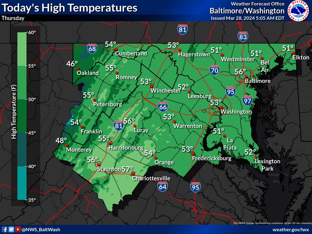
The region braces for unsettled weather patterns as a cold front sweeps eastward today, according to the National Weather Service. Low-pressure systems are expected to develop off the coast, contributing to continued rainfall across the area, mainly east of the Blue Ridge. The frontal passage will bring occasional light rain, with lingering showers expected into the afternoon along the I-95 corridor. While rainfall amounts may vary, southern Maryland could see totals exceeding an inch, while lighter amounts are forecasted elsewhere.
Behind the front, northwesterly winds are anticipated to pick up, with gusts reaching 20-25 mph and even higher velocities atop ridges. Despite the frontal passage, temperatures are only expected to rise marginally, reaching the lower to mid-50s for most areas, though some locations may experience slightly warmer conditions if breaks in cloud cover permit.
The clearing of clouds is anticipated for this evening, albeit temporarily, as another disturbance is forecasted to move through the region late tonight. This secondary disturbance may usher in a brief period of upslope snow showers, particularly in elevated areas, with accumulations expected to be minor, generally less than one inch. Overnight lows are projected to dip into the 30s across the region.
Looking ahead, high pressure is anticipated to build to the south on Friday, though the weekend and early next week are expected to bring multiple upper-level disturbances, prolonging unsettled weather conditions.