
 Prince William Parks and Recreation sponsors today’s weather forecast.
Summer Job Alert: Parks and Recreation Hiring Seasonal Workers Now! Want to earn some extra cash this summer and enjoy your job at the same time? PWC Parks and Recreation is now hiring for seasonal jobs.. Camp Counselors, Lifeguards, Cooks and more…
As residents are in unseasonably warm temperatures, the National Weather Service is alerted to an impending shift in weather patterns. Currently, in command, high pressure is poised to yield to a low-pressure system approaching from the Ohio Valley.
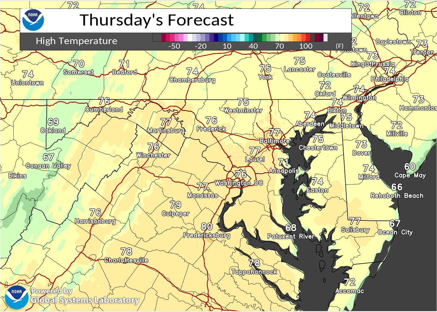
Today’s forecast promises continued dry conditions and temperatures well above the norm. Despite a mix of sun and clouds, highs are expected to reach the mid-70s to near 80. This warmth, however, will be short-lived as a change looms on the horizon.
Tonight, as the center of low pressure nears the Great Lakes, a warm front extending across portions of Pennsylvania heralds the onset of change. Overnight lows are forecasted to be well above average, with widespread 50s anticipated. While most of the region will remain dry, areas along the Alleghenies and the MD/PA border may experience light rain late into the night, primarily after midnight.
Looking ahead to Friday, the transition becomes more apparent. Rain, accompanied by a few thunderstorms, is expected to encroach upon the area, with the likelihood increasing as the day progresses. Cloud cover will intensify, keeping temperatures around the 77-degree mark. The evening brings continued chances of rain and thunderstorms, tapering off towards the late hours but leaving behind mostly cloudy skies and cooler temperatures in the high 40s.
This pattern sets the stage for a potentially unsettled weekend, with a weaker secondary system projected to affect the region from Sunday into Monday. Following the passage of these weather systems, a cooler air mass is anticipated to dominate much of the upcoming week, starkly contrasting the unseasonable warmth experienced in recent days.