
 Today’s weather forecast is sponsored by Water’s End Brewery. Serving fresh craft beer at four taprooms located throughout Northern Virginia! Visit us today to grab a flight and take some fresh craft beer with you to go!
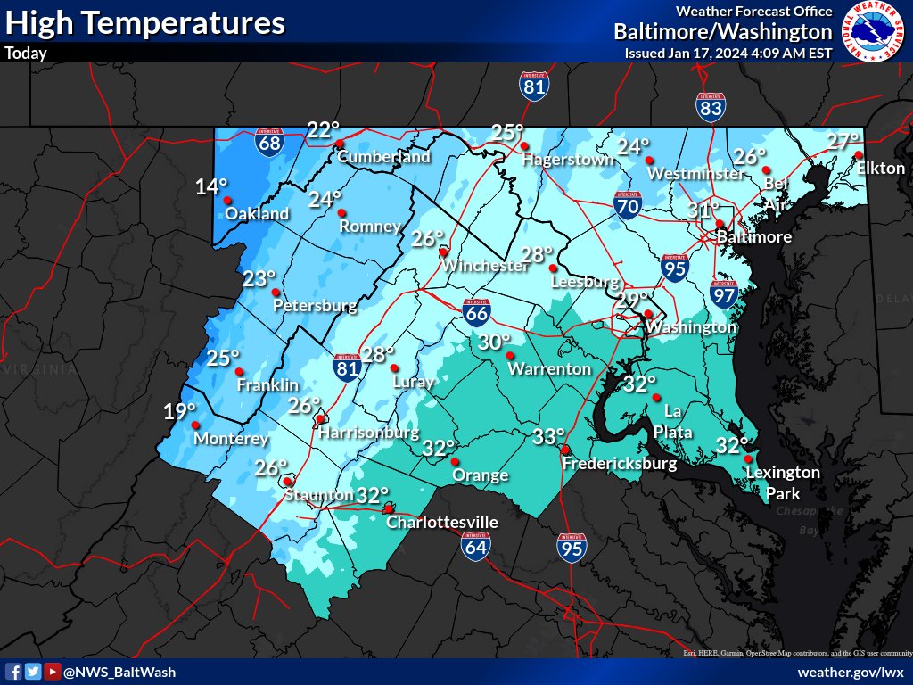
Today
Today’s National Weather Service forecast indicates clear and icy conditions as high pressure builds into the region from the southwest. In the afternoon, high temperatures will struggle to reach the freezing mark, mainly southeast of Washington DC and along U.S. Route 29 from near Washington DC to Charlottesville.
In the western and central zones, wind chill remains a factor early in the day, prompting a Wind Chill Advisory for the Blue Ridge until 10 am and for the western ridges until early afternoon. While there are no wind chill advisories for other areas, wind chills will still be in the teens to lower 20s across much of the region today. High pressure will move overhead, leading to dry conditions.
Tonight
Overnight lows will range from single digits in the western ridges to the lower 20s along the Chesapeake Bay.
Thursday and Friday
The National Weather Service forecast indicates that Thursday will be dry with increasing high clouds, offering milder temperatures than the previous day. Highs on Thursday will range from the middle 20s in the west to the middle 40s along the Chesapeake Bay, accompanied by sunshine.
However, an upper-level disturbance is expected to follow a cold front Thursday night into Friday, bringing the potential for accumulating snowfall. The main snow accumulation is anticipated on Friday morning, especially in higher elevations, with the entire area having the chance to see snow accumulation. Southern Maryland and areas north toward Annapolis and the Chesapeake Bay Bridge might experience a mix of rainfall and snowfall due to a slightly warmer air wedge from the southeast.
Temperatures on Friday are expected to be below average, with highs in the upper 20s and low 30s. Following this, a blast of Arctic air on Friday night will result in low temperatures falling back into the single digits and teens, accompanied by gusty northwesterly winds that will create single-digit wind chills.
