
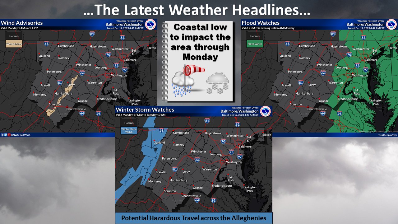
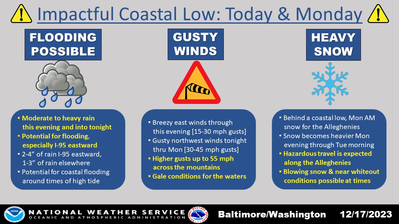
“A high-impact coastal low will move into the area by this afternoon. Moderate to heavy rain is likely this evening into the overnight. Winds become increasingly gusty tonight into Mon. Out west, the Alleghenies can expect snow, heavy at times, Mon afternoon through Tue morning,” reports the National Weather Service Baltimore-Washington Office.
Sunday
Rain, mainly after 10 am. High near 57. Northeast wind 5 to 10 mph, becoming east in the afternoon. The chance of precipitation is 100%—new precipitation amounts between a quarter and half of an inch possible.
Sunday Night
Rain before 10 pm, rain and possibly a thunderstorm between 10 pm and 4 am, then rain after 4 am. Some of the storms could produce heavy rain—low around 49. Northeast wind 10 to 17 mph, becoming north after midnight. Winds could gust as high as 28 mph. The chance of precipitation is 100%. New rainfall amounts between 2 and 3 inches possible.
Monday
Showers likely before 1 pm. Cloudy, then gradually becoming mostly sunny, with a high near 52. Breezy, with a west wind of 19 to 24 mph, decreasing to 13 to 18 mph in the afternoon. Winds could gust as high as 40 mph. The chance of precipitation is 60%—new precipitation amounts between a tenth and a quarter of an inch possible.
Monday Night
A slight chance of showers after 1 am. Mostly cloudy, with a low of around 31. West wind 8 to 11 mph. The chance of precipitation is 20%.
